


Words & pics Robert Crack
The Darling River Run isn’t ‘just another outback track’. It’s landscape. It’s literature. It’s living culture. And it is light that will have you removing your camera lens cap so often that after sunset each day you’ll feel as though you have repetitive strain injury.
With so much to experience along this river route, and so many detours branching off from it, we’re bringing it to you in two parts. For part one, we’re kicking off with Walgett, Brewarrina, Bourke, Gundabooka National Park and the Baaka itself.

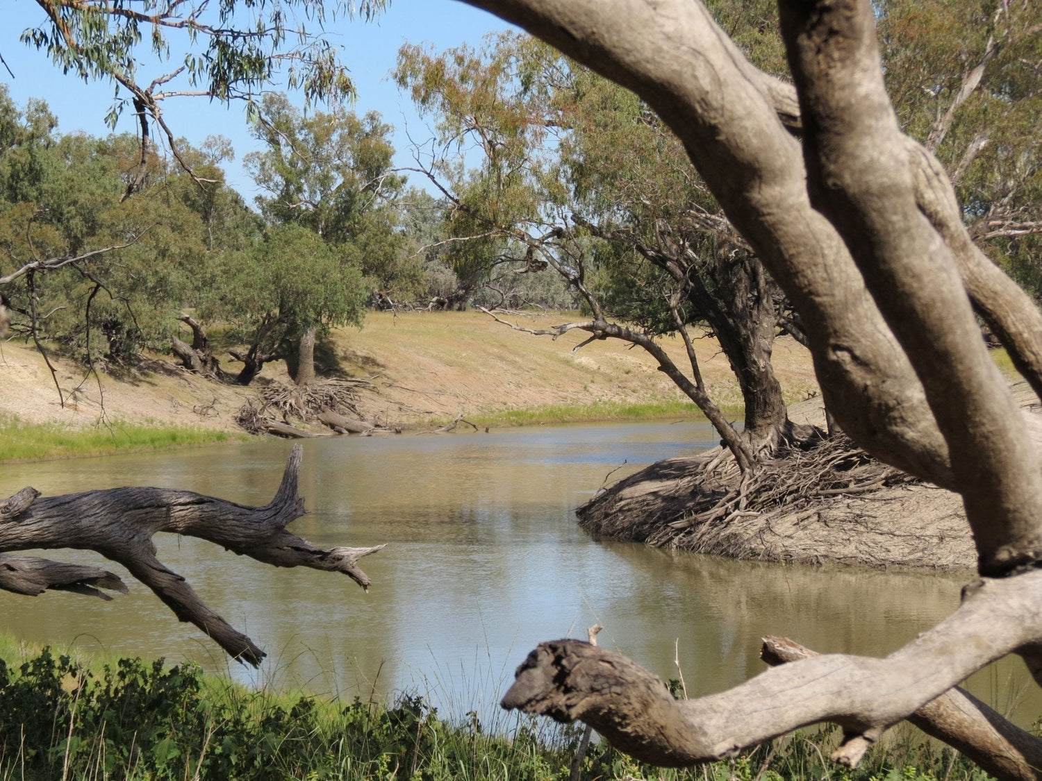
The Darling River between Gundabooka National Park and Louth
It starts as a thin blue line on your Hema Map. But on the ground, the line is decidedly brown, not blue.
There’s something about the Darling / Baaka River … Is it the slow, chocolate-coloured water sliding past ancient river red gums? Is it the silence? Or is it the fact that you can pull up beside the bank, set your swag down and feel like you’ve stepped back 100 years?
Maybe it’s all three.
It’s a river of stories, red dirt, river gums and wide horizons.
The Darling River winds its way through western New South Wales before surrendering to the Murray River at Wentworth. Fed by summer rains from southern Queensland, the Barwon–Darling system drifts south-west across vast floodplains, through the heart of outback NSW and through towns that live and breathe the river.
The Darling River Run is a touch above 950km when travelling from Walgett in the north to Wentworth in the south, along the eastern side and tracking the river’s journey through some of NSW’s most character-filled country towns.
But it isn’t just a drive through outback NSW — it’s a journey through living history, Aboriginal culture, pastoral grit and proper bush hospitality. From Walgett to Wentworth, this is remote touring done right.
You can start at either end. Head upstream from Wentworth. Or roll south from Walgett. There’s no rulebook here.
Why drive it? Because there’s something about a river road. It draws you in. It slows you down. It reminds you that Australia’s inland isn’t empty — it’s alive.
What makes the Darling River Run special isn’t just the point-to-point distance, it’s the detours. The national parks. The bush pubs. The station stays. The big skies and bigger characters. The Darling forms the backbone of outback NSW. And from its quill and shaft, just like barbs on a feather, dozens of worthy side trips branch out.
Why drive the Darling River Run?
Because this is real bush Australia.
You’ll encounter:
- River red gums (Eucalyptus camaldulensis) leaning over still waterholes and riverbanks
- Coolabah-lined floodplains stretching to the horizon
- Historic inland ports and crumbling paddle steamer relics
- Aboriginal cultural sites tens of thousands of years old
- Sunrises that turn the sky apricot, and sunsets that burn it crimson
It’s not a technically challenging drive overall and is suitable for soft-roaders in dry conditions — though a high-clearance 4WD gives you flexibility for side trips and national parks.
The Darling River Run comprises relatively safe dirt roads, gentle offroad stretches and endless room to breathe.

First things first: road conditions
Let’s get this out of the way, eh?
Most roads along the Darling River Run are unsealed. They can and do close after rain. They dry quickly — but if a road is closed, it’s closed. Fines apply, and wheel ruts wreck these fragile dirt surfaces.
At time of writing, much of the Darling River Run is closed due to water over the road. These closures include East Tilpa Road, West Tilpa Road, Nelyambo Bridge Road, Curranyalpa Road, Toorale Road, Wilcannia-Menindee Road and West Wilcannia Road.
But they won’t be closed forever, so it’s time to start planning and preparing for your Darling River Run!
Update on 26 March 2026: Bourke - Louth, Louth - Tilpa (East Side), Louth - Tilpa (West Side), West Tilpa Road and East Tilpa Road are open. Wilcannia - Menindee Road (East) and West Wilcannia Road are closed.
For the latest information, visit Live Traffic NSW and check the Central Darling Shire Council’s Road Report on 08 8091 5155 or centraldarling.nsw.gov.au.
“Water, water, every where, Nor any drop to drink.”
Commonly misquoted as “Water, water everywhere, but not a drop to drink.”, this verse from Samuel Taylor Coleridge’s 1798 poem The Rime of the Ancient Mariner, could easily apply to the Darling River Run.
In the poem, a ship’s crew is stranded and dying of thirst despite being surrounded by water. The irony is that there is an abundance of a resource, but it is either dangerous, useless or inaccessible.
On the Darling River Run, more often than not there is an abundance of water, but it can be dangerous to swim in it, draw it or drink it.
Before starting your Darling River Run, stock up on extra water. Don’t rely on drawing water from the Darling and treating it. Not only might there be toxic cyanobacteria (bacteria containing phycobilins and chlorophyll, a.k.a. blue-green algae, which cannot be effectively treated with iodine or chlorine dioxide tablets because killing the algae releases the toxins), but also the banks of the Darling are so steep in so many places that if you take your camp bucket down to the river to draw water, you might find that you’re not able to get back up the bank.

The riverbanks are often high, steep and muddy, particularly in the middle and lower reaches.
Play it safe and play it smart. Carry the potable water supplies that you’ll need. Don’t rely on the river.
Walgett
The name ‘Walgett’ is derived from the Kamilaroi word meaning ‘meeting of two waters’.
Aptly enough, Walgett is set at the junction of the Namoi and Barwon rivers. It’s a friendly outback town which blends country charm with solid amenities. It’s a key agricultural hub, a top fishing spot and home to relaxing artesian bore baths. At time of writing, the Walgett Artesian Bore Bath was closed, however it is expected to reopen in April, in time for the season.
It’s also a natural start — or finish — for the iconic Darling River Run.

Walgett War Memorial
Brewarrina
Brewarrina is small in size but enormous in cultural weight.
Just downstream of town lie Baiame's Ngunnhu — the Brewarrina Fish Traps. Estimated to be more than 40,000 years old, this intricate network of stone weirs is believed to be one of the oldest man-made structures on Earth. For millennia it was a meeting place for ceremony, trade and storytelling.
It's also a meeting place for briefs of Australian Pelicans (Pelecanus conspicillatus) that have got taking turns and working in a cooperative, coordinated fashion to maximize their fish intake, down to a fine art.

The Barwon River threads through town, but just downstream the Culgoa joins it — and from that confluence, the river officially becomes the Darling.
It’s a fitting place to begin.

View upstream from our free campsite on the Barwon River in Brewarrina's Four Mile Camping Reserve. Facilities include toilets, woodfired barbecue, fishing jetty and boat ramp.

Bourke
Roughly 100km to the west via the Kamilaroi Highway (or around 135km if you take the alternate, unsealed route from Brewarrina to Bourke following the Culgoa River), Bourke curves around a broad bend in the river. The name alone sits deep in Australia’s national psyche.
Bourke is more than just a sign on the Mitchell Highway.
River trade shaped this region. This was once a bustling inland port, connected to the outside world by paddle steamers hauling wool. Today it’s a remote but unique regional hub with plenty to see:
- Back O’ Bourke Exhibition Centre
- Historic cemetery and sandstone buildings
- PV Jandra paddle vessel cruises
- Access to Toorale and Gundabooka national parks (and Mount Oxley if you purchase a permit from the Back O’Bourke Visitor Information Centre)
Start at the Back O’ Bourke Information and Exhibition Centre. It’s more than a visitor centre — it’s an immersive introduction to the region’s layered history. The Standing Stories sculpture walk, with its audio-visual elements, shares stories from 22 Indigenous language groups of the Bourke area.
Other exhibits explore themes such as the Inland Sea legend, the wool industry, riverboat trade and the life of journalist C.E.W. Bean, along with stories of Henry Lawson and the pioneering women of the west.
Before becoming Australia’s official war correspondent during World War I, Charles Edwin Woodrow Bean worked for The Sydney Morning Herald. In 1909 he travelled to far western New South Wales, based himself in Bourke and reported on the wool industry and the people whose lives revolved around it — drovers, shearers and riverboat crews.
Those experiences shaped two influential books: On the Wool Track (1910) and The Dreadnought of the Darling (1911), which documented life along the Darling River and the resilience of outback communities.
Bean believed the values he witnessed in the bush — mateship, endurance and quiet humour — helped define the Australian character. Many soldiers who fought at Gallipoli in 1915 came from similar rural backgrounds, linking Bourke’s outback heritage to the story of the ANZACs.
Today, visitors can explore these powerful stories and discover how Bourke helped shape Australia’s national identity.
No Darling River journey feels complete without a stop at Bourke. And it’s the Back O’ Bourke Exhibition Centre that adds context to the roads and tracks you’re driving.
Because this river has seen it all.

Bourke Wharf
And if you doubt that? That’s OK. But only once you’ve read news articles from the late 1800s:
“All the plains along the river from Wilcannia to the latter station [Nelyambo Station] are liable to inundation, and the soil possesses the usual loose character of such country. It is a marl, or mixture of clay and lime-earth, enriched by deposits from the floodwaters of the river through untold ages. When wet it adheres to the feet of man and beast, and to dray-wheels till movement becomes a burden; but when dry it soon crumbles to powder by the action of the sun's rays, as is the case with all marls. Like all rivers which flow through level tracts of country, the Darling is very crooked. It has a general course from north-east to south-west, but it often turns back upon its course, and the narrowness of the channel, and its many short angles, render navigation difficult.”*
“Visitors to Bourke, now that the late flood waters have subsided, could not possibly believe that that important inland centre of population had only a few months since stood in imminent peril of being demolished by what is known as the great Darling flood of 1890, which, commenced in February of that year and reached its height about May and June last.”^
The Darling River Run follows a river that has always done its own thing, and it takes in country that sits at the heart and soul of Australia’s Aboriginal history and our European pastoral history.
There’s nowhere better for you to learn about these histories than the Back O’ Bourke Exhibition Centre.
Allow time. It’s worth it.
The PV Jandra, a replica paddle steamer, was built by fruit farmer and Bourke local Russ Mansell and his family in 2000. The Jandra is the namesake of the original PV Jandra, which was a steam paddle boat on the Darling in the 1890s.
Here at Hema Group, our very own Amelia Mansell (Russ’ granddaughter) has fond memories of cruising on the modern-day PV Jandra with Russ himself at the wheel. Born and raised in Bourke, Amelia knows Bourke better than anyone else at Hema Group. If you want to read up about Bourke before you embark on your Darling River Run adventure, check out the feature article ‘Back O’ Bourke: An iconic New South Wales adventure’ that Amelia wrote for Caravan World in 2024.
As for today’s PV Jandra? Its naissance marked the end of a 60+ year ‘drought’ of paddle boat operations on the Darling.
Don’t miss it.
Bourke surprises people.
It’s layered. It’s resilient. And it’s still very much alive.

One of the beautiful buildings at Bourke Riverside Motel
Bourke to Louth — Gundabooka National Park and river country
Southwest of Bourke, the river country opens up. Photographers will love the contrast here — burnt-red earth against deep blue skies.
You can detour into:
- Toorale National Park — fishing, birdwatching, camping and epic sunsets
- Gundabooka National Park — Ngemba and Barkinji country, rock art at Yapa (Mulgowan) Art Site and walks through Bennetts Gorge to Mount Gunderbooka
Gundabooka National Park spreads across almost 64,000 hectares of rugged outback terrain.
Think red dirt plains, mulga woodland, sandhills, rocky ranges and wide skies that seem to stretch forever.

Heading to Gundabooka National Park
Marked walking tracks weave through the park, rewarding travellers with big views, wildlife encounters and a glimpse into ancient Aboriginal culture.
Must-see highlights:
- Yapa (Mulgowan) Aboriginal art site walking track — view remarkable rock paintings created by the Ngemba and Barkindji / Paakantyi peoples. The paintings sit beneath a vast rock overhang and include animal figures, dancers, hand stencils and traditional hunting tools. These artworks reflect thousands of years of culture and ceremony in the Mulareenya Creek area of the Gundabooka Range. A viewing platform protects the fragile artwork. Stay on the platform and take the time to appreciate the stories captured in stone.
- Bennetts Gorge picnic area is a great place to stop for lunch or fire up a barbecue.
- Little Mountain walking track — climb to the summit lookout for sweeping views across the Gundabooka Range. Starting near Dry Tank campground, the Little Mountain walking track follows a red-earth trail through mulga woodland. It’s an easy walk for most visitors, and the reward comes at the end — Little Mountain lookout, where the entire northern escarpment of the Gundabooka Range unfolds before you. Sunset here is something special indeed.
- Valley of the Eagles Walk(Ngana Malyan) — a short stroll leading to a scenic platform at the base of Mount Gunderbooka. Mount Gunderbooka itself towers roughly 500m above the surrounding plains, creating one of the most striking landforms in outback New South Wales.
For an overnight (or longer!) stay, Dry Tank campground provides a comfortable base from which you can explore the park. There are 20 unpowered sites. This campground is suitable for tents, caravans and camper trailers. Facilities include toilets, barbecue facilities and picnic tables. There are rainwater tanks however you will need to bring your own water supplies for cooking and drinking, as well as your own firewood. Advance bookings are required.
Need a quiet riverside camp with a bit more comfort than bush camping in Gundabooka National Park? Rose Isle Station ticks the box.
Set 70km downstream of Bourke on the Darling River Run, this family-run property blends wide river views with relaxed, well-spaced camping. Choose from powered lawn sites, river camps or fully equipped cabins and cottages, all backed by solid amenities.
Mornings are a highlight—homemade tea by the river is hard to beat.
Be sure to book ahead, especially for river sites and accommodation.

White-winged Fairy-wren (Malurus leucopterus). Even if you're not a 'bird nerd', the dry-country avifauna in Gundabooka National Park will likely attract the camera lens of many a four-wheel driver who likes photographing nature.
What's next?
This is just the curtain raiser. The first few hundred kilometres between Walgett and Louth.
Keep an eye out for part two, when we’ll take in the other 600km+ of the Darling River Run.
Out here, rushing achieves nothing. So we shan’t be rushing it.
Because the Darling moves slowly.
So should you.

Road conditions sign (not current). For the latest information, visit Live Traffic NSW and check the Bourke Shire Council Road Conditions Report as well as the Central Darling Shire Council’s Road Report.
“Water, water, every where,
Acknowledgment and citations
Quoted newspaper articles referred to were sourced from Trove, a collaboration of the National Library of Australia and hundreds of partner organisations around Australia.
^1891 'DOWN THE DARLING AFTER THE GREAT FLOOD OF 1890.', South Australian Register (Adelaide, SA : 1839 - 1900), 24 February, p. 6. , viewed 20 Feb 2026, http://nla.gov.au/nla.news-article48086356
*1874 'TRAVELLING ON THE DARLING.', The Maitland Mercury and Hunter River General Advertiser (NSW : 1843 - 1893), 1 January, p. 2. , viewed 20 Feb 2026, http://nla.gov.au/nla.news-article18780434
Maps
Related articles
Outback New South Wales — 5 summer destinations you can’t miss
Free and budget campsites: New South Wales


