


 Part 1: 1983-1998
Off-road explorers were discovering Australia’s desert centre with confidence after the famous 1998 Great Desert Tracks expedition, with the first Hema map series to be entirely field-checked, drawn and updated digitally signalling the start of Hema Maps’s technological evolution.
Digitally crafted and updated maps had superior accuracy and presentation to those drawn by traditional methods, which led to a complete overhaul of every Hema map. Starting with six weeks of field-checking Cape York in 1999, within three years the company had completely redrawn their maps of the Kimberley, Fraser Island, the Flinders Ranges, High Country Victoria and of course Cape York.
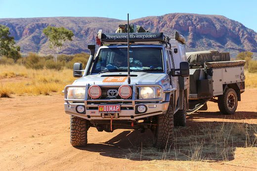
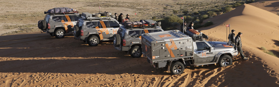
Now Managing Director Rob Boegheim was the driving force behind the project, and was often the man behind the wheel of the field-checking vehicle known as the Map Patrol.
“GPS surveying to digitally check our mapping meant that the information was easier to gather and more accurate, but took longer to do because there was now so much more information to collect than before,” he says.
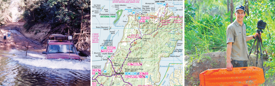 LEFT TO RIGHT: It took six weeks of field checking to digitise Hema Cape York in 1999; The current Cape York map that looks and performs better than ever; Managing Director Rob Boegheim in Cape York this year.
Hema Maps’s choice to digitise its database came not a moment too soon, as more and more explorers began using GPS digital navigation to find their way in remote areas.
“Within two or three years it had changed from hand-held GPS devices that gave coordinates to be matched with a paper map, to dedicated street navigation systems with voice directions,” Rob says.
The conception of the Hema Navigator in 2007 coincided with this jump in technology, and a year later the HN1 was the first portable navigation system in Australia that offered navigation for both on and off-road use. The HN1 pre-packaged all the navigation off-road travellers needed in one device, making it easier than ever for explorers to confidently travel to the wildest parts of Australia.
A technical support team was assembled to back the move into digital navigation, which was new territory to a company that previously produced traditional paper maps, atlases and guides.
“Before the Hema Navigator, people never came back unless the paper ripped.” Rob says.
This technological transition made navigation more reliable for four-wheel drivers by showing them exactly where they were on a Hema map, while simultaneously and perhaps more importantly opening up more off-road areas through the assurance of GPS technology. Improved voice guidance, 4WD Track data and integrated Camps Australia Wide POIs (and other innovative features) were added with the subsequent releases of the HN5, HN5i and HN6, each one offering explorers a more complete navigation system for discovering the road less travelled.
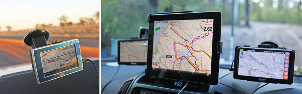 LEFT TO RIGHT: The original Hema Navigator HN1 brought a complete navigation device to off-road explorers; in 2013 Hema Maps offers multiple digital navigation solutions.
To match the growing capabilities of digital technology and the expectations of the four-wheel drivers and tourers using it, explorers began searching for devices that could cater to more travel needs than simply navigation.
“Ten years ago the idea was that Wi-Fi connected cars were the way of the future, and though that is now true it came in a different way than expected.” Rob says.
“Instead of the onus being on the car to carry our messages, music, maps and apps, it’s all about the devices we use everyday.”
The rise of the smartphone affirmed this obsession with multi-purposed digital devices, and Hema Maps rose to the challenge with the 2011 release of its 4WD navigation app, 4WD Maps. The in-built GPS receiver of WiFi+Cellular iOS devices allowed explorers to use their iPhones and iPads as fully-fledged offline navigation systems, with the mass adoption of these devices as travel partners conclusively changing the current technological landscape while opening up its future applications.
“Our future devices will be more connected (to online services and the broader needs of travellers), not only to take the complexity out of navigation but to offer explorers the information they want, when they want it.”
It’s an exciting prospect, with the current consensus being that navigation is becoming a fully interactive experience that shapes the path each individual adventure takes.
“First it was a paper map, then a dedicated GPS navigation system and now apps for smartphones and tablets; whatever happens, the unique and accurate content we offer to our customers and the advantages that has are the same today as it was 30 years ago, albeit in ever-changing forms.” Rob says.
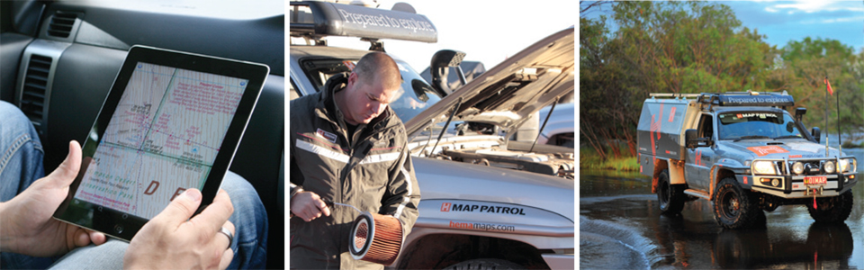 LEFT TO RIGHT: The dominance of smart devices in daily life has changed how technology fits into our lives; The Map Patrol is just the first step of many when it comes to making a Hema map; The job of Map Patrol explorer is a big responsibility.
“To frame it another way, over one million dollars has gone into the 300,000km of roads and tracks we have field-checked since 1996,which has all been an investment to ensure the quality and accuracy of our map content.”
Rob is quick to add that while field checking has been a key part of Hema Maps’s identity, the unseen collaborative side of the company is equally important, which includes the field-checkers themselves, the company’s talented cartographers, book authors, designers, data processors and more. Each role fits together to produce the navigation in all forms that explorers use, with the expertise involved in each field mandatory to construct the premium quality products the company is known for.
This constant stream of reliable navigation products and the necessary risks to provide them have stemmed from the passion for discovery that Hema Maps has pursued over the last 30 years. The company and the explorers it serves are one in the same, both seeking the satisfaction that comes from the power of the journey and where that journey takes them. For the company that has built a reputation a cround exploration, the real adventure is continuing this trend; an unknown path of countless adventures that started in 1983, which for the passionate explorers at Hema Maps is the journey that will never end.


