


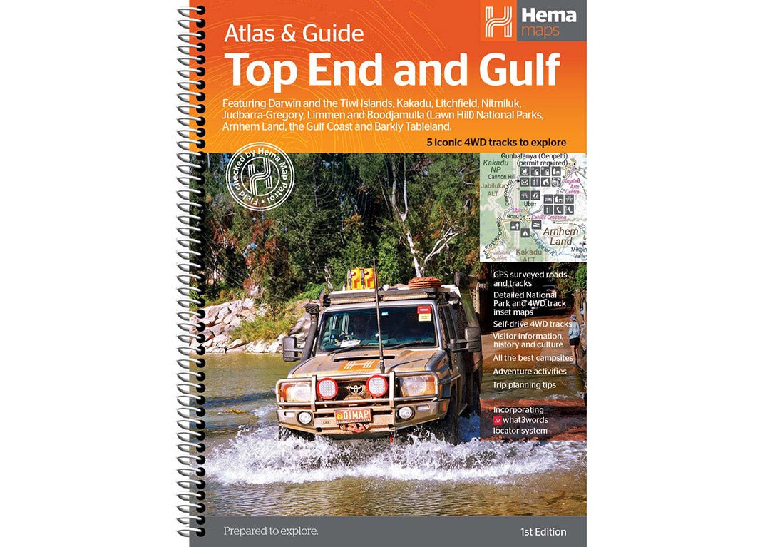

Hema Maps, Australia’s leading publisher of trusted and verified maps, is thrilled to announce the release of a brand-new product: the 1st Edition Top End and Gulf Atlas & Guide.
We created this new product to continue to make companion guides for our bestselling regional and iconic maps. This informative guidebook was written by travel writer and photographer Chris Whitelaw.
The new 1st Edition Top End and Gulf Atlas & Guide exists as an indispensable companion for anyone undertaking a grand expedition of this famous area, featuring Darwin and the Tiwi Islands; Kakadu, Litchfield, Nitmiluk, Judbarra/Gregory, Limmen and Boodjamulla* (Lawn Hill) National Parks; Arnhem Land; the Gulf Coast and Barkly Tableland.
Extensive cultural information and stories — along with historical tales from the Indigenous and European development of the region — provide prospective travellers a new and exciting way to learn about this unique part of the world.
 The East Alligator River at Cahills Crossing, NT (Credit: Patrick Kemp)
Also included in this new guidebook are the top five 4WD trips, including: Boodjamulla* (Lawn Hill) National Park, Limmen National Park, Judbarra/Gregory National Park, West Arnhem Land: Cobourg Peninsula and the Hardies and Wildman River.
Each trip is coded by vehicle type with suitability symbols and relevant information regarding permit requirements and contact details. Track profiles show the difficulty grading, elevations and distances as well as points of interest (POI), camping areas and supply points.
This atlas and guide goes beyond the beaten track, offering insights into private camping areas and caravan parks, ensuring you have a range of accommodation options. There is also an index and a list of Accredited Visitor Information Centres within the Top End and Gulf to help you get the most out of your trip.
This 232-page atlas and guide is packed with more detail than ever before, all of which has been extensively field-checked by Hema’s Map Patrol and Alpha Teams.
 Berry Springs, NT (Credit: AdobeStock)
On the release of this new product, Hema Maps Chairman Sam Hayward comments, “Hema is delighted to release this First Edition guidebook of this iconic region. Full credit to author Chris Whitelaw for capturing the essence of the region and bringing it to life. We’re also delighted with the detail in the mapping, so a big thanks to our cartography team too. We hope it gives inspiration to the travelling public and facilitates many happy holidays. Safe journey from us all.”
With comprehensive details on towns, national parks, accommodation options, beaches, attractions, five famous 4WD trips, pre-trip planning and much more, you can be sure you will have all the information you require for an enjoyable, interesting and exciting foray into the Top End and Gulf of Australia.
The 1st Edition of the Top End and Gulf Atlas & Guide ($59.95) is available now on the Hema Maps website and at leading retail stores.
*At time of writing Boodjamulla (Lawn Hill) National Park is closed for redevelopment.
 Fishing at Dundee Beach near Darwin, NT (Credit: AdobeStock)
About Hema Maps:
Hema Maps has been Australia’s trusted leader in mapping and navigation solutions for more than 40 years. Founded in 1983, it has grown from a local map publisher into an iconic brand with comprehensive coverage of Australia and beyond. Hema’s passion for exploration drives the company to create products that empower travellers, adventurers and outdoor enthusiasts to navigate with confidence and discover new horizons.


