


Words Julija Zivanovic and Ron and Viv Moon Pics Matt Williams and Supplied
Our country’s driest state is full of challenging and picturesque 4WD tracks, especially in the Flinders Ranges region. Keep reading to discover our four favourite Flinders Ranges tracks.
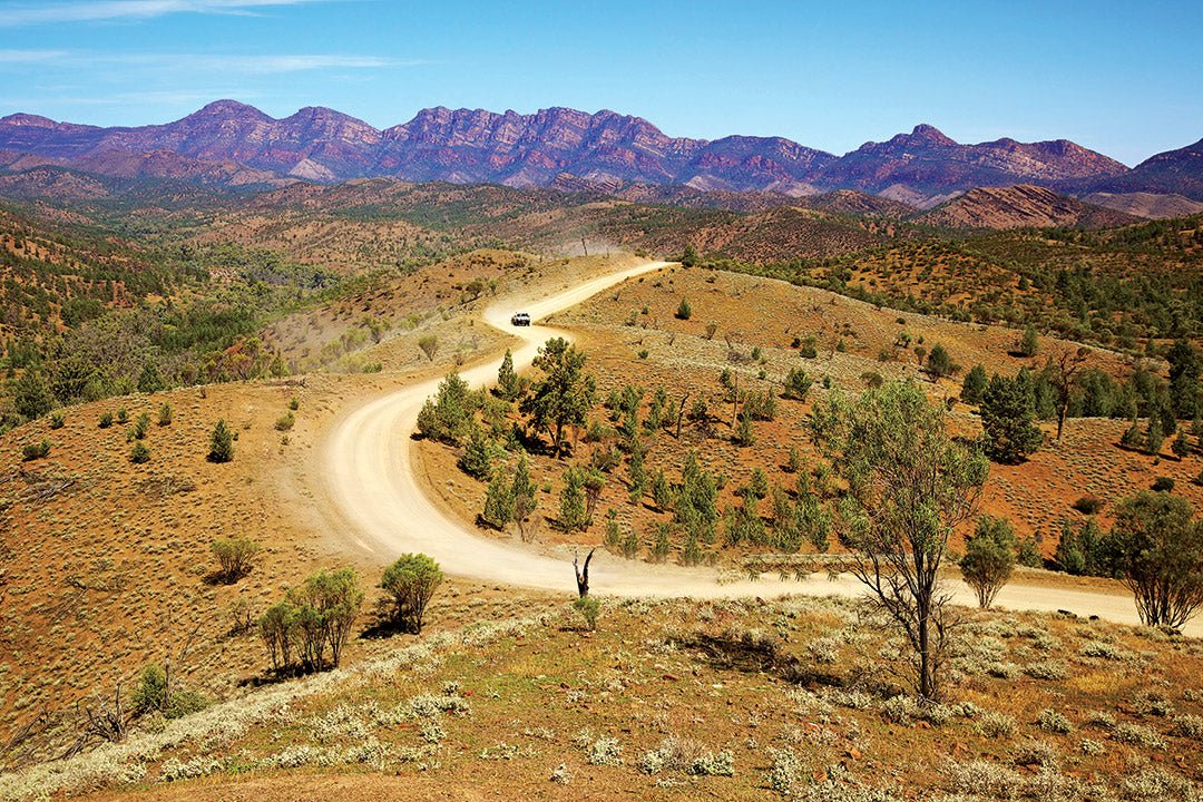
 Wilpena Pound, Ikara-Flinders Ranges National Park
South Australia — known for its beautiful beaches, rustic outback and desert experiences and being Australia’s largest producer of wine (to just name a few) — is also home to some fantastic four-wheel drive tracks. But with so many awesome tracks/experiences to choose from, which are the best/should you undertake first?
We asked our Hema Map Patrol team to vote for their favourite Flinders Ranges tracks and we’ve narrowed down the results to just four, some of which are in incredible, rugged locations, yet only five or so hours north of Adelaide.
Join us as we explore the epic journeys of the Skytrek Track, Bridle Track, Ikara-Flinders Ranges National Park (Bunyeroo Valley and Brachina Gorge loop) and the Mount Gill Track.
4WD track grading
All four-wheel drive trips covered by Hema Maps are given a difficulty rating to help adventurers easily determine if they and their vehicles can tackle the track. They are given one of four grades:
Easy — All-wheel drive and high range, novice drivers
Medium — Mainly high-range 4WD but low range required, some 4WD experience or training required
Difficult — Significant low-range 4WD with standard ground clearance, should have 4WD driver training
Very Difficult — Low-range 4WD with high ground clearance, experienced drivers only
1. Willow Springs Station’s Skytrek
This is a spectacular self-guided track and the alien-like landscape which surrounds it is something, we believe, all should see at least once in their lives. The vast open landscape in every direction is very humbling … and is the perfect spot for relaxation and reflection.
 The Skytrek offers plenty of different terrain to traverse (Credit: Matt Williams)
Before we get into some tips for tackling Skytrek on Willow Springs Station, here’s the essential information.
The details

Please be advised that a $70 per vehicle cost is incurred for driving this track as it is on private property, paid to the reception desk at Willow Springs.
Grade: Medium — mainly high range 4WD but low range required. Some 4WD experience or training required.
Time: 7 hours
Distance: 79km
Longest distance without fuel: 200km (from Hawker return)
Best time of year: April to November
Important contacts: Willow Springs Station — 08 8648 0016
Accommodation: Willow Springs Station
The drive
Willow Springs Station’s Skytrek is one of the most well-regarded self-drive 4WD tracks in the Flinders Ranges region. You’ll likely get to sight wild kangaroos, emus, eagles and other local birds while completing this drive, plus plenty of dramatic landscapes rising from the orangey-red dirt.
The track initially zigzags southeast from Willow Springs through a river gorge among broad, rolling hills. It then bends away from Buffalo Creek to travel northeast to the old Moxan’s Hut.
Continuing north, the track is easy to follow with points of interest clearly sign-posted along the way. There are 50 well-signed markers on the route which indicate spots of significance, such as ancient Aboriginal etchings, noteworthy flora or fauna, ochre cliffs, waterholes and much more.
You can pick up an information sheet from the office at Willow Springs which has detailed information about each of the 50 stops. You can pick and choose which ones to stop at and inspect.
 The alien-like landscape along the Skytrek is a sight to behold (Credit: Matt Williams)
The track is fairly easy going early on, with the main challenges coming in from the occasional rocky sections and washouts. After 65km, as you near the old Willow Springs Waterhole, there are some steep sections and a few tricky spots that will require plenty of careful low-range navigation.
These efforts are rewarded with a stunning panorama from atop Upalinna Lookout, which takes in the entire Ikara-Flinders Ranges National Park and Wilpena Pound to the southwest.
 Some of the Hema Maps and REDARC teams taking a breather on the Skytrek track in August 2024 (Credit: Matt Williams)
One of the best ways to end the day is atop the main ridge with an expansive view over the stunning South Australian outback. It’s a great place to process the unforgettable experience and just take in the serenity.
2. Bridle Track
The Bridle Track just north of Adelaide is a great drive that offers stunning views over Spencer Gulf and Port Germein.
 Hema Maps convoy climbing the Bridle Track (Credit: Matt Williams)
Now, before we get into the drive itself and nearby attractions, here’s some essential information.
The details

Grade: Easy — all wheel drive and high range. Novice drivers.
Time: 2 hours
Distance: 34km Port Germein to Melrose
Longest distance without fuel: 52km (Port Pirie to Melrose)
Best time of year: Any time
Important contacts: Burra & Goyder Visitor Information Centre — 08 8892 2154
Accommodation: Melrose Showgrounds Camping Area, Melrose Caravan Park, Port Germein Caravan Park — or 20km north on the A1 takes you to Mambray Creek, a Map Patrol favourite!
The drive
The Bridle Track in the Southern Flinders Ranges is one of the gems of the area and rewards drivers with the most sensational views over Spencer Gulf and Port Germein. The popular four-wheel drive track starts about a three-hour drive north from Adelaide, near to Mount Remarkable National Park, and takes approximately three hours to complete. The track is also suitable for towing in dry conditions.
 (Credit: Sam Richards)
Starting from Port Germein, drive out of town along Germein Gorge Road, then head north along Pipeline Road for 3km to the Bridle Track. About 8km north from here and visible from the high point of the Bridle Track is the Baroota Reservoir (built in 1921).
From here, the track climbs onto the southern ranges on easy terrain, with the occasional steep section to keep things interesting. As the track rises it offers wide views of Spencer Gulf to the rear, with a few fantastic spots — especially the Six Poles Lookout — from which to take great pictures! (As seen below …)
 The breathtaking views from Six Poles Lookout (Credit Matt Williams)
The route from here passes through a large area of open dry forest studded with native grass trees (Yaccas) and plenty of native wildlife to enjoy.
After the initial climb, the track rolls along a broad grassy ridgeline before coming to Survey Road, where you can turn right to Bangor and the main Germein Gorge Road or follow our designated route which takes you past several peaceful properties of the Southern Flinders Ranges Wine Region towards Melrose.
3. Ikara-Flinders Ranges National Park (Bunyeroo Valley and Brachina Gorge loop)
If you’re visiting the Flinders Ranges region for the first time, we recommend not missing the opportunity to do the full Bunyeroo Valley and Brachina Gorge loop, one of the best scenic drives in Australia. The majority of the drive is on well-maintained gravel roads and can be easily driven in an AWD vehicle. The last 30km is on the bitumen.
Before we get into this circuit track, here’s some essential information on the drive.
The details

Grade: Easy — all wheel drive and high range. Novice drivers.
Time: Allow a full day for plenty of stops along the way
Distance: 85km (loop), 116km (with extensions)
Longest distance without fuel: No fuel along route, except at Wilpena Pound Resort
Best time of year: All year round
Important contacts: Wilpena Pound Resort — 08 8648 0048
Accommodation: Teamsters Campground, Koolamon Campground, Youngoona Campground, Trezona Campground, Dingley Dell Campground, Cambrian Campground, Aroona Campground, Acraman Campground, Discovery Resorts - Wilpena Pound, Brachina East Campground
The drive

This particular loop track can be undertaken in either direction, though for the purposes of this journey, we’ve opted to head in a clockwise direction.
Heading west on the Bunyeroo Valley Road first takes you across lightly undulating country and rolling hills that are lightly treed with native pine, while old red gums line the occasional creek. Red kangaroos along with emus are commonly seen through this section of the drive.
It’s worthwhile to stop and explore the area around the restored Yanyanna Hut — a pug and pine shepherd’s hut from the 1850s. Then from here, the road winds through hills closely packed with regrowth native pine to the first of the viewpoints, the Bunyeroo Valley Lookout. Now, as grand as the view is here, the next lookout a short distance on is the Razorback Lookout, with mind-blowing views (see for yourself in the picture below).
 View from Razorback Lookout (Credit: Getty Images)
This is the most recognisable view in the region, as the road winds along an undulating ridgeline before it dips out of sight into Bunyeroo Gorge, while the magnificent Heysen Range stands proud in the background.
From the Razorback there is a steep descent to Bunyeroo Creek — the track passes sheer red bluffs and craggy peaks. From here the road passes between the lines of peaks which make up the Heysen Range to the west — the highest peak in the immediate area is Mount Rupert at 560 metres. To the east are the lower peaks of the ABC Range.
Once the Bunyeroo Valley Geological Drive reaches Brachina Gorge, you can turn east to complete the circuit, but if you’re not in a hurry, one can turn west along the Brachina Gorge Road to Brachina Lookout, then return eastwards through the Brachina Geological Trail. This is a spectacular drive — over 20km you travel through 130 million years of history. Or you can take the 14km round trip (7km each way) to Aroona Homestead, which is also a worthy detour.
4. Mount Gill Track

One of the most enjoyable tracks in South Australia, this trip follows rugged country and scenic beauty hard to find elsewhere in this country. Combining classic elements of the Flinders Ranges along a diverse four-wheel drive track, the Mount Gill Track is the jewel of the Warraweena Station Conservation Park.
The details

Grade: Difficult — Significant low-range 4WD with standard ground clearance, should have 4WD driver training.
Time: Allow one day
Distance: 35km
Longest distance without fuel: No fuel on track — closest is at Copley, 60km from Warraweena
Best time of year: June to September
Important contacts: Warraweena Station Conservation Park — 08 8675 2770
Accommodation: Warraweena Station Conservation Park
The drive
The Mount Gill Track begins as you leave the homestead for a slow drive along a dry creek bed that turns into an undulating ridgetop trail, with rocky hill climbs and various lookouts serving as ideal vantage points to appreciate the topography of the ranges that roll to the horizon. This track is driven in an anticlockwise direction.
Warraweena presides over some of the highest peaks in the Flinders Ranges (Mount Gill sits at 914m), meaning on a clear day the lookouts can offer views of Lake Frome to the east, Lake Torrens to the west and Wilpena Pound in the south.
 The grand view from the top of Mount Gill
Just 12km from the homestead you come to Cockatoo Hut, but the drive here can easily take an hour or so. Stretch the legs and check out the hut and the surrounding area along with Cockatoo Well.
Soon after leaving the hut, you’ll pass through a locked gate and then turn into Bullocky Creek before starting a steep climb to a track junction where you need to turn right. The last 3.5km section that leads to Mount Gill is a remarkable trail that follows the ridgeline to the summit, giving panoramic views on either side as the track stretches out before you.
After the summit, backtrack to the track junction and descend straight down the ridge where there are more rocky sections and dry creeks to negotiate on the way back to complete this memorable trip.
Grab a copy today!

The above information was mostly extracted from the Hema Flinders Ranges Atlas & Guide which features 13 famous 4WD tracks in the Flinders Ranges region — plus a wealth of information on the area, including the natural environment, history, trip planning and things to see and do. Let us guide you the next time you venture off the beaten track.
You can purchase a copy of the Hema Flinders Ranges Atlas & Guide on the Hema Maps website or at participating retailers.
Hema Tours
If you can’t muster a ready-made convoy, join Hema Tours for a 4WD tag-along tour, full of adventure and discovery. Hema Tours are powered by the Adrenalin Offroad Centre, licensed commercial tour operators. Find out more here.


