


Looking for isolation and solitude in the outback? Here are the most remote 4WD tracks Australia has to offer.
One of the most appealing prospects of an offroad adventure is getting into isolated areas where people are few and far between. Here are the most remote 4WD tracks in Australia for travellers seeking solitude along their journey. Remember, due to the rough nature of the tracks, careful planning is required.
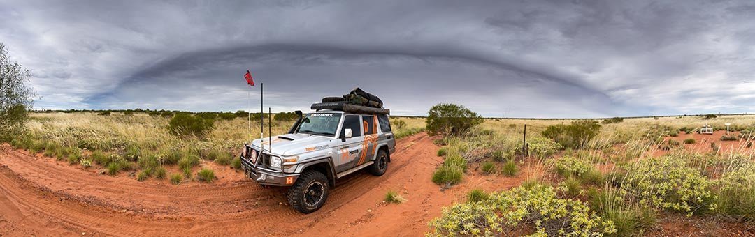
1. Anne Beadell Highway

The details
Grade: Medium — mainly high range 4WD but low range required. Some 4WD experience or training required.
Driving time: 24 hours (average speed 55km/h)
Distance: 1375km, Laverton to Coober Pedy
Longest distance without fuel: 815km, Ilkurlka Roadhouse to Coober Pedy
Best time of year: May to September: avoid summer months as temperatures are extremely high. Remember that in other seasons, night temperatures can drop below freezing, so come prepared.
The drive
It may be shorter and less challenging than the revered Canning Stock Route, but the Anne Beadell Highway is just as remote and less travelled than the CSR. Unmaintained and largely untouched — with a lone supply point available in Ilkurlka Roadhouse — the Anne Beadell is an epic journey that cuts through the dune-filled expanses of the Great Victoria Desert for 1324km from Laverton to Coober Pedy. Travel is slow, the landscape is rugged and traffic is non-existent, meaning it’s not uncommon to encounter no one else for days on end while on this week-long adventure.
Further information regarding this drive, its warnings, fees and permits needed, camping options, important contacts and much more can be found in Hema’s Great Desert Tracks Atlas & Guide.
2. Madigan Line

The details
Grade: Medium — mainly high range 4WD but low range required. Some 4WD experience or training required.
Driving time: 32 hours (average speed 15km/h)
Distance: 716km, Mount Dare to Birdsville
Longest distance without fuel: 716km, Mount Dare to Birdsville
Best time of year: Cooler months: April to October
The drive
While the southern crossings of the Simpson Desert have become increasingly well known among four-wheel drivers in search of a desert adventure, the remote northern section maintains a heightened atmosphere of isolation. Occasionally feeling more like a cross-country jaunt than a track, the Madigan Line follows the marked camps of Dr Cecil Madigan’s 1939 expedition, which resulted in a rugged and direct route across the Simpson Desert that Madigan describes in his book, Crossing the Dead Heart.
Further information regarding this drive, its warnings, fees and permits needed, camping options, important contacts and much more can be found in Hema’s Great Desert Tracks Atlas & Guide.
3. Gary Highway

The details
Grade: Medium — mainly high range 4WD but low range required. Some 4WD experience or training required.
Driving time: 10 hours (average speed 31km/h)
Distance: 325km, Gary Junction to Everard Junction
Longest distance without fuel: 891km, Kiwirrkurra to Warburton; 878km, Kiwirrkurra to Carnegie Station; 675km, Kunawarritji to Warburton; 662km, Kunawarritji to Carnegie Station
Best time of year: Cooler months: May to September
The drive
As far from a highway as one can imagine, the Gary Highway is a mainly two-wheel track through flat spinifex country that is renowned for linking a variety of tracks blazed by Len Beadell and the Gunbarrel Construction Company. The fact that it’s topographically benign and uncomplicated to drive (in comparison to its neighbours) means the Gary Highway is less pursued than the Gunbarrel Highway and Gary Junction Road, making it one of the most remote tracks in one of Australia’s most remote regions.
Further information regarding this drive, its warnings, fees and permits needed, camping options, important contacts and much more can be found in Hema’s Great Desert Tracks Atlas & Guide.
4. Talawana Track
 (Credit: Matt Williams)
The details
Grade: Medium — mainly high range 4WD but low range required. Some 4WD experience or training required.
Driving time: 15 hours (average speed 42km/h)
Distance: 646km, Windy Corner to Newman
Longest distance without fuel: 523km, Kunawarritji to Parnngurr
Best time of year: Cooler months: May to September
The drive
Linked to the Gary Highway is the Talawana Track, a rough and often corrugated journeysojourn that passes by the southern edge of Karlamilyi National Park and through the Gibson Desert. The last track built by Len Beadell, the Talawana connects Marble Bar Road with Windy Corner on the Gary Highway and intersects with the more challenging (but equally punishing) Canning Stock Route. Featuring beautifully desolate desert landscapes punctuated by hardy spinifex, the Talawana Track is a drive for those who are prepared for isolation.
Further information regarding this drive, its warnings, fees and permits needed, camping options, important contacts and much more can be found in Hema’s Great Desert Tracks Atlas & Guide.
5. Nyangumarta Highway
 (Credit: Matt Williams)
The details
Grade: Difficult — significant low range 4WD with standard ground clearance. Should have 4WD driver training.
Driving time: 15 hours (average speed 45km/h)
Distance: 681km, Gary Junction to Eighty Mile Beach
Longest distance without fuel: 651km, Kunawarritji to Sandfire Roadhouse
Best time of year: Cooler months: May to September
The drive
Formerly called the Kidson Track, the Nyangumarta Highway is an abandoned oil exploration track that cuts through the Great Sandy Desert to 80 Mile Beach north of Port Hedland. Shifting from red sand to a flat or washed-out gravel track, the Nyangumarta has no water access and offers little relief from the elements of the outback along the way, making it a lonesome and self-sufficient journey through the heart of Australia’s second-largest desert.
Further information regarding this drive, its warnings, fees and permits needed, camping options, important contacts and much more can be found in Hema’s Great Desert Tracks Atlas & Guide.
Great Desert Tracks Atlas & Guide

The abovementioned tracks are featured in our bestselling 6th Edition atlas and guidebook: Great Desert Tracks. This informative guidebook with full atlas section covers the whole Red Centre of Australia and the iconic four-wheel drive tracks within them — all field checked by the Hema Map Patrol. Plus, this edition provides crucial pre-trip reading, guiding you on how to effectively prepare for your desert trek.
To purchase a copy of Hema’s Great Desert Tracks Atlas & Guide ($69.95), head to the Hema Maps website.
Related articles
The best of the Top End and Gulf


