


Words Hema Maps Editorial Pics Supplied
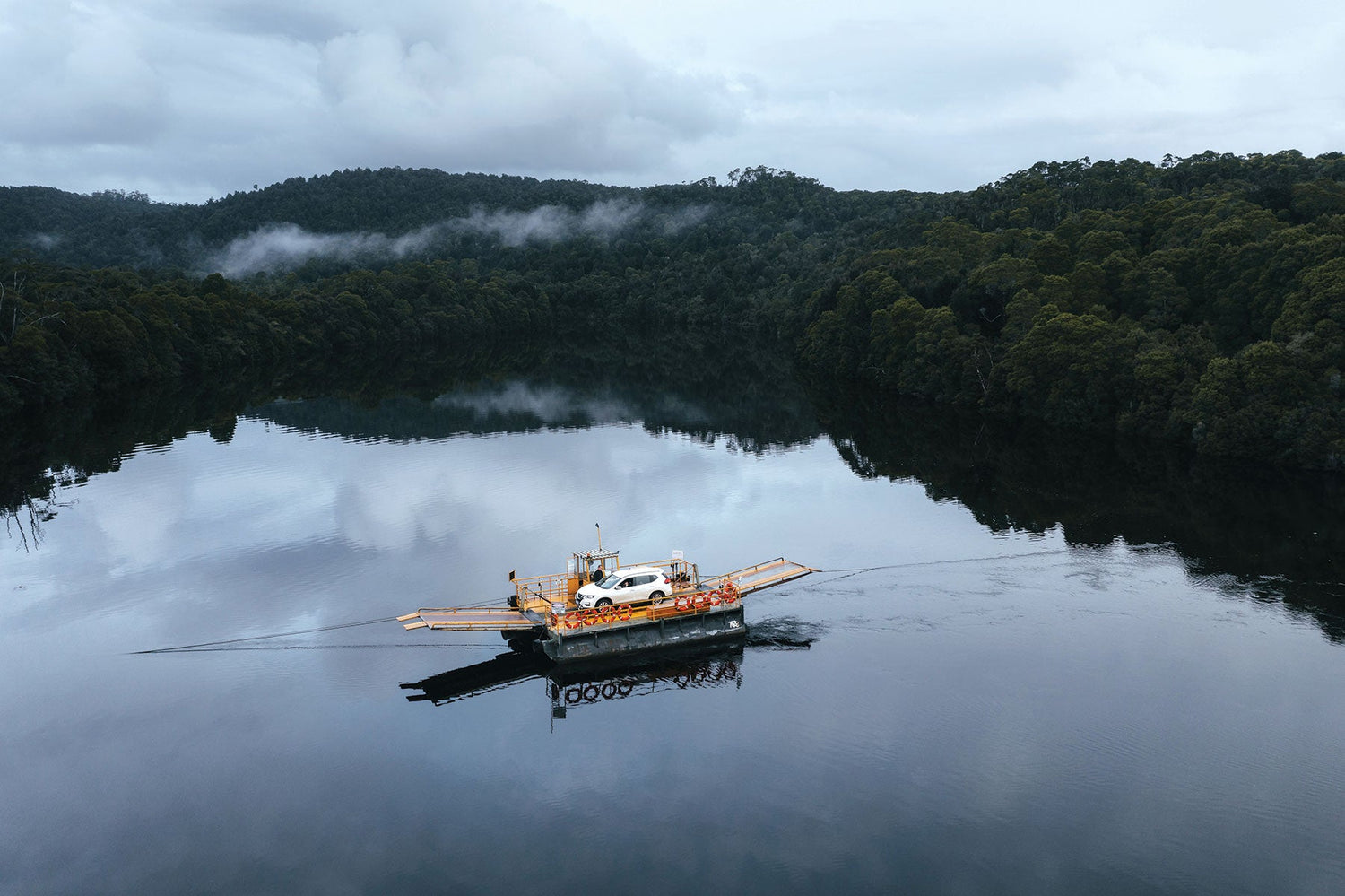
The island state of Tasmania is a nature lover’s paradise — featuring beautiful scenery, epic national parks, rugged terrain and super-fun rocky tracks. Read on to discover our five favourite 4WD tracks in Tassie.
The 2nd Edition of Hema’s Tasmania Atlas & Guide features 15 of Hema’s favourite 4WD tracks that stretch from the spectacular vistas of Hells Gates on the western coast to the colourful granite-rock beaches of the Freycinet Peninsula. The atlas includes distinctive and informative maps, all of which have been field checked by Hema’s Map Patrol to ensure the best possible accuracy with the latest mapping data.
Author Matt Brogan said the Tasmania Atlas & Guide will help adventure-seekers discover Tassie’s many sites and attractions.
“It suggests possible itineraries, things to see and do, places to stay and learn, and it offers detailed maps to help you navigate your way around,” Matt said. “Our only suggestion is to take your time here, experience as much as you can and challenge yourself to discover something new. This is a special place and one that continues to reward those who take the time to get to know it.”
Before we get into the top five tracks, our general advice is to visit in the drier summer months and to always drive to the track conditions.
Pyengana Jeep Track
The Pyengana Jeep Track winds through the temperate rainforests of Tasmania’s northeast and can be extremely difficult when wet or after rains.
The bog holes of the Pyengana Jeep Track have been known to drown the occasional 4WD, and if the mud doesn’t get you, the ruts will. This track is rated Very Difficult for a reason — it is. It’s best tackled in a lifted 4WD fitted with differential lockers and mud tyres and should only be attempted by experienced four-wheel drivers with the right recovery gear.
Winding uphill from the St Columba Falls car park, this slippery track presents several rutted climbs and step-ups before reaching the summit. Once there, the mud holes continue across an elevated section of track which rarely sees sunlight beneath the towering forest canopy. It’s recommended the track is tackled in Tasmania’s drier months and that the condition of the track is clarified with locals before heading in. Access to the track is shared with timber trucks which have right of way on unsealed roads.

Pyengana Jeep Track on the map
Track details
Grade: Very Difficult — significant low range 4WD with high ground clearance. Experienced drivers only.
Time: 1–2 hours
Distance: 8km
Best time of year: October to March
Permits and fees: Not required
Highlights: St Columba Falls, The Pub in the Paddock (Please note that at time of writing, St Columba Falls State Reserve walking track is currently closed because of track damage and fallen trees. For more information contact the St Helens Field Centre (Tasmania Parks & Wildlife Service) on 03 6397 5510.
Getting there: From Pyengana, take the C428 (St Columba Falls Rd) to the St Columba Falls car park, or from Mathinna, take the C423 (Mathinna Plains Rd) then Mt Albert Rd to the Pyengana Jeep Track intersection. Fuel is available in nearby Ringarooma (to the northwest), further south in Fingal or in St Helens on the coast.
Climies Track

Credit Scott Ferrari, Hema Alpha Team member #003
Arguably Tassie’s most famous four-wheel driving trip, Climies Track should only be attempted by vehicles with high ground clearance, dual range 4WD, mud terrain tyres and a full complement of recovery equipment. It follows a hilly coastal route through Mount Heemskirk Regional Reserve between Trial Harbour and Granville Harbour and provides stunning views over the Southern Ocean.
Because of the low, scrubby vegetation, there are no trees to winch from so this track is best tackled as a group. Picturesque waterfalls, clifftops and mountain views are encountered along the route. Hill climbs, bog holes, rocky river crossings and rutted sections punctuate this hilly coastal trail.
Travellers must be self-sufficient, and you must carry your own firewood if intending to camp.
As with any 4WD track, Climies Track needs to be preserved for future travellers. Stick to the designated track and avoid making new tracks around difficult sections. Always cross creeks and rivers at designated crossing points only. Due to the sensitive nature of some vegetation, it is crucial that your vehicle and equipment are cleaned prior to beginning Climies Track to prevent the spread of plant and animal disease in the surrounding area.

Climies Track on the map
Track details
Grade: Very Difficult — significant low range 4WD with high ground clearance. Experienced drivers only.
Time: 5–6 hours
Distance: 19km
Best time of year: October to March
Permits and fees: Not required
Highlights: Carn Brae Mine (disused), Cornwall Mine, Southern Ocean and Wheel Bay views
Getting there: Climies Track is best accessed via the C248 (Trial Harbour Rd) which extends from the C249 (Heemskirk Rd) just north of Zeehan. Although limited supplies may be available at Trial Harbour, the most reliable source of fuel is from Zeehan to the track’s southeast.
Sandy Cape Track
Driving in the north of Tassie's west coast, Credit Sean Scott
Located within the Arthur-Pieman Conservation Area, the Sandy Cape Track is a scenic drive providing outstanding coastal views and beautiful camping spots. As the area is quite remote, it’s recommended you fill up at Marrawah if entering from the north.
From Temma to Greenes Creek, approximately 12km, the trip is rated as an Easy track (all-wheel drive and high range, novice drivers). However, it can become slippery and more difficult after heavy rain with deep water sections. The later beach section of the drive, from Greenes Creek to Sandy Cape, is rated as Difficult. The track comprises a mix of sandy and rocky sections, as well as several water crossings.
Travelling in the company of other vehicles is essential along Sandy Cape Beach owing to the area’s soft sands. Vehicles have been known to become irretrievably trapped in sections of the beach and caution is advised. Always check the conditions before driving on the beach as large swells can impact the quality of the track. The same is true after heavy winter rains.

Sandy Cape Track on the map
Track details
Grade: Difficult — significant low range 4WD with standard ground clearance. Should have 4WD driver training.
Time: 2–3 hours
Distance: 26.5km
Best time of year: Any
Permits and fees: Arthur-Pieman Recreational Driver Pass — hit this link to get yours
Contact details: Arthur River Field Centre — 03 6457 1225 or visit parks.tas.gov.au/explore-our-parks/arthur-pieman-conservation-area
Highlights: Aboriginal sites, coastal views, Bartel’s monument
Getting there: The Sandy Cape Track is accessed by first following the C214 (Rebecca Rd) west from Kanunnah Bridge or south from Arthur River. Head south at the intersection of Temma Rd near Couta Rocks and follow the road until it intersects with the Sandy Cape Track. Fuel is available at Zeehan or Smithton.
Montezuma Falls Track

This challenging central Tasmanian 4WD track is sign-posted as the North East Dundas Tramway as it was once the route of an ore tramway which shuttled mined rock from the Williamsford Mine to Zeehan.
Rated Difficult with a capital ‘D’, the Montezuma Falls Track is a challenging route for even the most experienced four-wheel driver. The 15km one-way route can take between three and six hours, depending on weather and the condition of the track, but is worth the drive for the many tramway cuttings the track passes through and the mining relics encountered along the way.
Set in picturesque rainforest dense with leatherwood, myrtle and sassafras, the track provides access to the highest waterfall (104 metres) in Tasmania. The falls may be accessed via a short walk from the track’s end, crossing a suspension bridge en route. Just before reaching the falls, look for an old mining adit driven into the rockface to your left.

Montezuma Falls Track on the map
Track details
Grade: Difficult — significant low range 4WD with standard ground clearance. Should have 4WD driver training.
Time: 3–6 hours
Distance: 15km
Best time of year: Any
Permits and fees: Not required
Contact details: West Coast Visitor Information Centre — 03 6472 6800 or visit westcoasttas.com.au
Highlights: Montezuma Falls and nearby suspension bridge, Williamsford mining ruins
Getting there: Also known as the North East Dundas Tramway, the track is accessed from the point where it intersects the A10 (Murchison Hwy) near the location of Melba. The nearest fuel is available at Rosebery to the north and Zeehan to the southwest.
Pieman Heads Track

Credit Sean Scott
(At the time of publication, some tracks in the Arthur-Pieman area were facing closure owing to Aboriginal heritage values. Please obey all signage and do not drive on closed tracks.)
Pieman Heads can be accessed via two tracks: the more common Coastal Track and the difficult Inland Track which are part of the more extensive Arthur-Pieman recreational vehicle track network.
Beginning at the fishing village of Granville Harbour, the Pieman Heads Coastal Track heads north along the rugged coastline of the Southern Ocean to the quaint beach shacks at Pieman Heads.
There is no defined track along Four Mile Beach, and you will need a keen eye to spot the exit at the beach’s northern end before continuing to Pieman Heads. Be sure to check tide times before traversing the beach and only cross at low tide. Beware of strong sea surges and swells in poor weather.
The Pieman Heads track offers breathtaking coastal scenery and a look at some of the area’s more interesting backcountry, including as many as 35 sites of Aboriginal significance. This heritage, combined with the natural beauty of the area, makes the Pieman Heads Track one of the best 4WD experiences in the state.
The region is largely uninhabited, so you must carry your own supplies, including drinking water. You will also need to make sure you have plenty of fuel.
The alternate and more difficult route to Pieman Heads is via the Inland Track. This 7km trail takes more than two hours to complete and should only be attempted in groups of two or more vehicles. It is quite boggy and wet in sections. Always carry recovery gear.

Pieman Heads Track on the map
Track details
Grade: Difficult – significant low range 4WD with standard ground clearance. Should have 4WD driver training.
Time: 2–3 hours
Distance: 27km
Best time of year: Any
Permits and fees: Recreational Driver’s Permit
Contact details: Arthur River Field Centre — 03 6457 1225 or visit parks.tas.gov.au/explore-our-parks/arthur-pieman-conservation-area
Highlights: Aboriginal heritage sites, Southern Ocean views, Pieman Heads fishing shacks
Getting there: Pieman Heads via Coastal Route. From Zeehan, head north on C249 (Heemskirk Rd) and take the Granville Harbour Rd to enter the Pieman Heads Track from its southern end (via Top Farm Track). The nearest 24/7 fuel is available at Zeehan.
Pieman Heads via Inland Route. From the C252 (Heemskirk Rd) take the C249 (Corinna Rd) northwest before heading due west on Wilson Rd. Take a turn south to access Pieman Heads Rd shortly after the intersection with Top Farm Rd. The nearest 24/7 fuel is available at Zeehan.
Grab your copy today!

The five tracks featured in this piece were taken from the Hema Tasmania Atlas & Guide which covers Tassie’s top 15 4WD tracks and top five walking tracks, among a wealth of information on the history of Tasmania, the environment, planning and preparation and things to see and do.
The Tasmania Atlas & Guide is available on the Hema Maps website or at leading outdoor retailers.


