


Words Robert Crack Pics Rob Boegheim
Is this the world’s most remote 4WD track? Join us as we continue to explore the CSR.
In the first part of this series, we discussed whether or not the Canning Stock Route (CSR) is indeed the world’s most remote 4WD track — if you missed it, check it out here.
Now that we’ve made the call, it’s time to get down to business and tackle how to prepare for this remote 1850km route through the WA outback.
Be prepared!

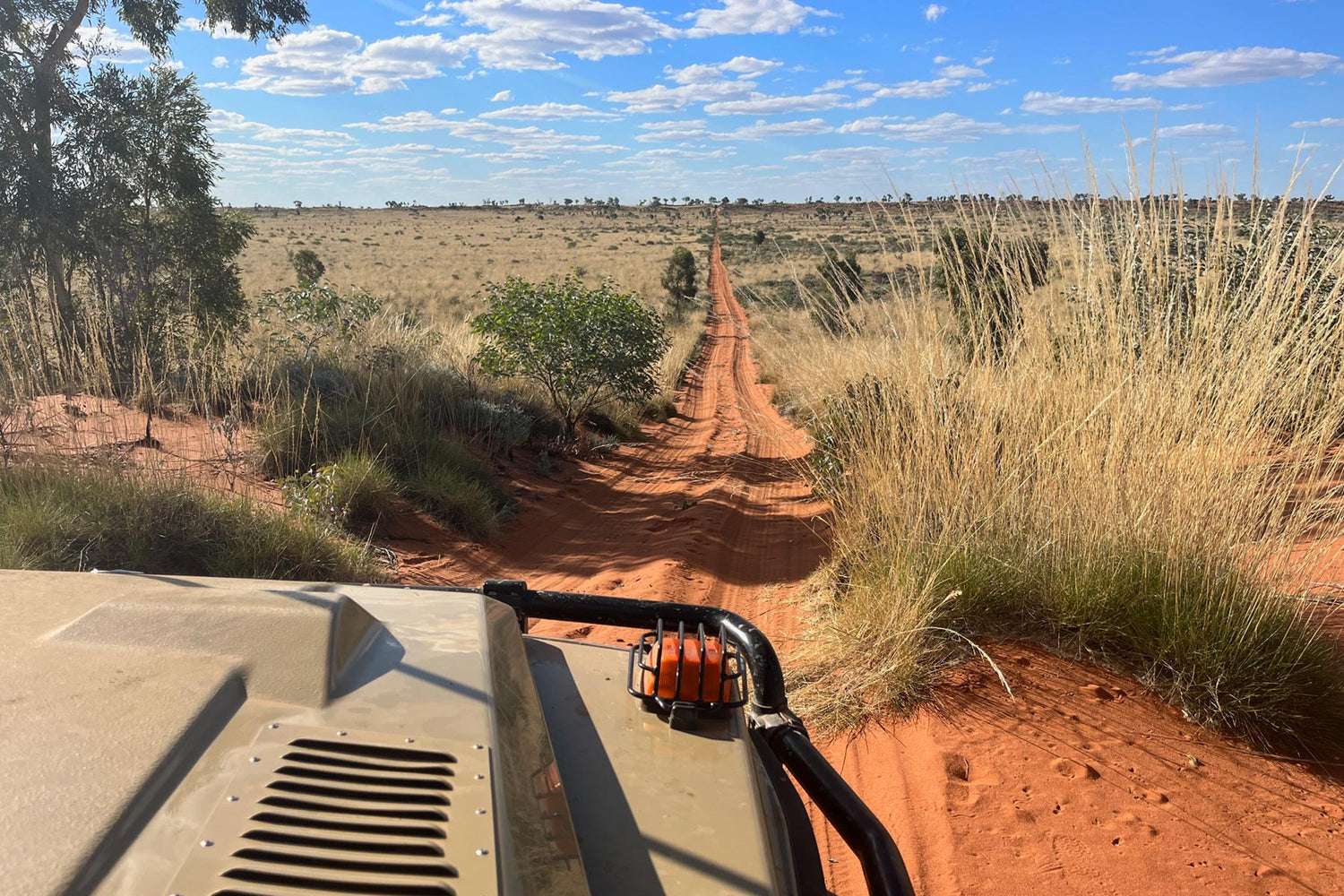
The Breaden Hills on the northern Canning
The CSR’s reputation as also being one of the toughest 4WD tracks in the world — as well as the most remote — is also thoroughly well-deserved. Make no mistake: this is a major trip necessitating much planning. To take a leaf out of Benjamin Franklin’s book, “By failing to prepare you are preparing to fail”.
The CSR is an extreme outback drive adventure, for which you’ll need to execute an unparalleled level of planning and have a very reliable vehicle carrying essential spare parts (including shock absorbers). Ideally, your vehicle should be one of a convoy of two to four vehicles since it is not advisable to travel alone.
At approximately 1850km (1590km ‘proper’ from Wiluna to Billiluna; 1850km ‘ish’ including the to/from Halls Creek segment), the Canning Stock Route (Yiwarra Kuju) is the longest historic stock route on Earth.
The CSR of today started its life as, well, a stock route. With lots of wells.
Many of these 51 wells sunk by Alfred Wernam Canning and his party to water livestock, are nowadays a real godsend for 4WD travellers.

Quality water is available from many of the restored wells. (Pic well 49)
Alfred Canning
Canning was a surveyor born and raised in Victoria. He worked in various locations in New South Wales before joining the Western Australian Lands Department in the 1890s. In the early 1900s, only a few years after Western Australia went from being a Colony to a State, the State Government of Western Australia planned a stock route that would facilitate the droving of cattle from the Kimberley region to feed the people of the goldfields, an area whose population had ‘boomed’ (by standards of the day) with the 1890s gold rush. During the Great Depression, Canning led a new expedition aimed at reopening the old stock route, having been all-but abandoned when the Port of Wyndham proved to be a better option for transporting live cattle southwards, by sea.
Canning may have walked during this expedition, but you don’t have to. Which is just as well, since the CSR traverses some of the harshest arid terrain anywhere in the world. This terrain calls for a reliable 4WD vehicle with high clearance, low range, light truck tyres and, ideally, after-market suspension.
The landscape changes perceptibly. The corrugations don’t. Some of the corrugations on the CSR make the Peninsula Development Road (PDR) in Far North Queensland seem as smooth as silk by comparison.
If you’re new to remote, long distance 4WD travel, the CSR is not the trip on which to cut your teeth. If the CSR was a job advertisement, it would include the words, “Only experienced offroad drivers with extensive outback driving experience need apply.”

Camping at Durba Springs
Climate and weather
We recommend taking at least two weeks, between the cooler months of April and September.
The flooding of Sturt Creek this year (Lake Gregory/Paruku has been particularly hard hit) has made driving the CSR to the north of Kunawarritji (Well 33) a risky venture (if not even impassable at times), especially the section between Well 51 and Billiluna. This section was cut off for months and may still be so. Travellers should always wait for the last of the Kimberley cyclones (April/May) before locking in their plans for the CSR that year as anything can change.
During flood-affected periods, the Kururrungku Store at Billiluna at the junction of the Tanami Road and the CSR, and the Wirrimanu Community Store in Balgo (around 35km off the Tanami Road) may run low on fuel and food.
Pay heed to what Kuju Wangka (representing the five Prescribed Bodies Corporate [PBCs] who hold the Wiluna, Birriliburu, Martu, Ngurrara and Tjurabalan Native Title Determinations along Yiwarra Kuju [the CSR] and also the permit agency for the traditional landowners’ groups) advises. If they (or the Martu land council, Jamukurnu-Yapalikurnu Aboriginal Corporation [JYAC]) advise travellers to leave the CSR at Kunawarritji, then that is what travellers should do. And if doing so, stick to the designated tracks — don’t make your own.

Sunrise over Kumpupintil Lake (Lake Disappointment)
Permits and contacts
Permits are required to traverse the CSR, and further fees apply to access it through some specific cattle stations.
To apply or find out more about the required permits, click this link.
For CSR permits enquiries, contact kujuwangka@outlook.com
For up-to-date information on track conditions and any closures:
-
Shire of Wiluna
P: 08 99818000
E: reception@wiluna.wa.gov.au
W: wiluna.wa.gov.au
For surrounding road conditions:
Fuel
Kunawarritji, near the intersection of Kiwirrkurra Road/CSR, is the only place on the CSR itself which has commercially available fuel. It’s around 1000km from Wiluna, so even if you have long range tanks, carrying extra fuel is advisable.
It’s worth noting that Parnngurr Community has commercially available fuel, however this entails an approximately 160km out-and-back detour at Georgia Bore along the Talawana Track and Cotton Creek Access Road into Karlamilyi National Park.
What you’ll need to bring

Sandy tracks for days on end!
We recommend 4 litres of drinking water per person per day. If there’s two or more people in your vehicle, for two weeks you’ll be carrying more than 100L of water and probably not much room for more. Accordingly, it’s best to be prepared to get water from Alfred Canning’s wells en route, which will mean a good quality bucket and a decent length (at least 5m recommended) of rope. Be sure to boil and treat well water with purifiers. All of the wells that have quality water have been kindly restored by the likes of Track Care WA, with working buckets, cables and winches. Be sure to keep the lids closed when not in use.
Some other must-have bits of gear are:
- Sand flag
- Recovery kit
- Air compressor
- Fire extinguisher
- Emergency position-indicating radiobeacon (EPIRB), personal locator beacon (PLB) or GPS messenger device such as Garmin inReach Mini 2 or ZOLEO Satellite Communicator
- Maps — it’s always wise to have a hardcopy in case your electrical devices aren’t available
- First aid kit
- Water purifiers
- Strong rubbish bags
- Fly net and insect repellent
- Toolkit
- Shovel
- Recovery / traction boards
- A bag with emergency supplies, including drinking water, non-perishable foods, blanket, sun protection and the like
Above all, bring your sense of adventure. On the world’s most remote 4WD track, you’re going to need it!
More information
If you would like to learn more about the Aboriginal Australian history and the European Australian exploration history of the CSR, check out the Canning Stock Route Guidebook.
For more detailed information about driving the CSR, including permit information, campsites, wells and track notes, check out this Hema Maps article by freelance writer and photographer Matt Williams.
And for more preparation, check out the Hema Great Desert Tracks Map Pack.
And as you begin your trip, be sure not to miss the Canning-Gunbarrel Discovery Centre in Wiluna.

Wild camels are a common sight
Related articles
The Canning Stock Route in Western Australia — part one


