


Words Julija Zivanovic and Ian Glover Pics Matt Williams and Supplied
Cape York is renowned for its wild beauty and difficult four-wheel drive tracks, which makes these offroad treks some of the toughest in Australia. Keep reading to discover our favourites.
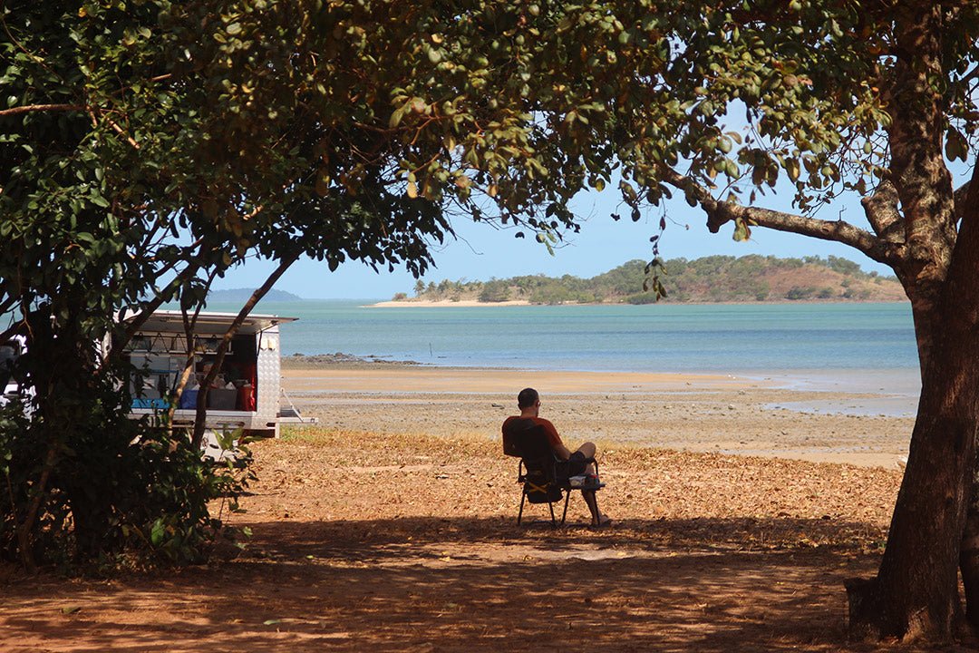
 The beach at Seisia, close to the top of Cape York, Queensland (Credit: Allison Watt)
The Cape York region in Queensland covers approximately 140,000sq km and is a must-visit location known for its warm climate, lush rainforest and the epic and challenging tracks that attract keen four-wheel drivers from all over the country. And the bucket list item on any trip to the Cape is reaching The Tip (Pajinka) — the northernmost point of Australia.
As we mentioned last week, the best time to visit Cape York is in the dry season from April to October. We’re currently in the wet season, but we have created this piece with preparation in mind, so we’ve given you plenty of time to plan your Cape York adventures come the dry season in a few short months.
It’s always tough narrowing down a rich area such as Cape York to bring you the best of the region, but we’ve managed to do so regarding the area’s 4WD trips, bringing you the Cape’s five best tracks.

Palmer River Goldfields
 (Credit: Matt Williams)
Away from the tropical jungles and savannah plains of Cape York’s most famous destinations are the dusty highlands of the Great Diving Range, which are home to one of the Cape’s most challenging drives: the Old Coach Road. The track climbs up and over the range, delivering steep ascents and descents on a rocky terrain, and includes unnerving washouts and rutted sections that can bring about a rollover if you’re not careful.
A spotter is essential for some obstacles and sections of the track, while a winch and diff locks — not to mention some solid experience behind the wheel — will make sure you can negotiate the drive safely.
The Palmer River Goldfields was once the largest and highest yielding alluvial goldfield in Australia, and so along the journey travellers will encounter mining camps and batteries at which to marvel. These relics, combined with its rough tracks and unique environment, make the Palmer River Goldfields one of Cape York’s most potent adventures.
Frenchmans Track
 (Credit: Matt Williams)
A rough shortcut from the Old Telegraph Road at Batavia Downs out to Lockhart River, Frenchmans Track is memorable both for its scenery and its 4WD challenges. The drive cuts through low-lying heath and deep rainforest on its way to the coast, while the terrain changes from corrugated dirt to clay, sand and exposed rock — within which are some of the toughest sections of track on the Cape.
The most famous obstacle along the track is the Pascoe River crossing (often the deepest in the region), which ends in a bare rock ascent that requires good planning and better driving to make it up the exit unscathed. Other parts of the track can be heavily corrugated, and can have large, rutted sections and washouts with which to contend.
The trip also delivers ample scenery to match the challenge of the drive, including the lush rainforests of Kutini-Payamu (Iron Range) National Park and the sight of Black Mountain’s collection of huge granite boulders — not to mention the secluded beaches found at the end of the drive.
The Old Telegraph Track
 (Credit: Matt Williams)
Cape York’s main artery pumps adventure travellers through its beating heart towards the outstretched limb that is The Tip, while placing a cavalcade of scenic highlights and offroad challenges in their path along the way. The Old Telegraph Track condenses so much of Cape York’s appeal into its length that it has become the definitive track in the region among seasoned veterans and the uninitiated alike, and despite this mantle the track still manages to deliver on its promise. It’s also in a great place for exploring nearby waterholes, such as the picturesque Fruit Bat Falls.
The track’s reputation is built largely on its array of water crossings, the most of which — Palm Creek, Gunshot Creek and Nolan’s Brook — will test the mettle of any four-wheel driver … so much so that spectators can often be seen watching the action from the sidelines during the peak season. Traction aids, recovery gear, support vehicles and correct driving technique are all preferable (and most often necessary) for anyone thinking of taking on the Old Tele’.
CREB Track
 (Credit: Matt Williams)
A tropical drive with hill climbs you would usually expect to find in the Victorian High Country, the CREB Track is a short ‘n’ sweet adventure that few are likely to forget. Its positioning south of Cooktown often makes it the first track on many a Cape York adventure, making it a baptism of fire for visitors to the region.
After a relatively easy start, the track ratchets up in intensity once it connects with the McDowall Range. The track’s incredibly steep descents and clay-based tracks make four-wheel driving experience a necessity as the consequences of an error in judgement on these sections can be dire.
Cape Melville National Park

One of Cape York’s most remote regions is also home to some of its most testing drives, which ensures only the most prepared and able travellers make it out to Cape Melville. The drive from Cooktown to Starcke Station is relatively benign as it cuts through pastoral land and overhanging rainforest, but after this point it becomes a true four-wheel drive trek: bulldust, washouts, ruts, potholes and stone shelves litter the ensuing track, making the going slow and rough for much of the way.
With low-range gearing engaged for large sections of the drive through Cape Melville National Park and soft sand dominating the beach drive to the Cape itself, the journey is a challenge on multiple fronts, which includes the need for total self-sufficiency.
Grab your copy today!

The above is an edited extract from the Hema Cape York Atlas & Guide, a 5th Edition guidebook which provides extensive and up-to-date information on the whole Cape York region of Queensland, including 15 of the TOP 4WD trips and 22 atlas pages. It also features detailed national park and track inset maps — all field checked by the Hema Map Patrol — visitor information, history and culture, all the best campsites, trip planning tips and much more.
This easy-to-use guidebook takes the difficulty out of planning a Cape York trip. You can easily purchase the Hema Cape York Atlas & Guide from the Hema Maps website or from leading retailers.
Related articles
7 reasons to visit Cape York — the northernmost tip of Aus


