


Words Robert Crack and Amelia Mansell Pics Jill Harrison and Supplied
In part one, we took a road trip from red rock to coral reef along the Gascoyne River. If you missed it, check it out here. In part two, we explore the red cliffs, blue waters and endless horizons that bookend the Upper Gascoyne.

Point Quobba, Shire of Carnarvon (Credit: Julia d'Orazio)
Clear turquoise water on one side, rugged red cliffs on the other — welcome to Australia’s Coral Coast. This region is home to Ningaloo Reef, manta rays, whale sharks, dolphins, sea lions… and some of the freshest seafood you’ll ever taste.
On land? Wildflowers, gorges, trails and enough outback tracks to keep any 4WD fan grinning.
Fishing is big here — which means your dinner is fresh off the boat. Western rock lobster, prawns and cockles are local staples, best enjoyed with tropical fruit or a cold one from a microbrewery.
This stretch of coast holds one of WA’s greatest treasures — Shark Bay, a UNESCO World Heritage site boasting 1000 kilometres of beaches and calm, shallow waters.
Swim with whale sharks, then detour to the famous Pink Lake — a short drive from Geraldton or Kalbarri.
Red cliffs. Blue water. Fresh seafood. Outback tracks. Star-filled skies. The Coral Coast and the Murchison region aren’t just a stop — they’re the heart of Western Australia’s wild beauty. So fuel up, check the road reports for Shire of Carnarvon, Shire of Upper Gascoyne and Shire of Murchison, check your permits and point your bonnet to this stretch of WA, one of Australia’s best-kept secrets.
 Sunset at Murchison River Bush Camp (Credit: Jill Harrison)
The Murchison — the heart of nowhere, full of stories
Between WA’s lush south-west and the big-ticket Pilbara and Kimberley lies a region most people drive past without a second thought. The Murchison. Its borders are fuzzy — Paynes Find in the south, Meekatharra up north, Sandstone and Wiluna to the east, Gascoyne Junction to the west. Ask three locals, you’ll get three answers.
But the stories here? They’re gold dust.
Cue in the rush for colour

Government buildings, Cue (Credit: Jill Harrison)
On New Year’s Day 1892, Mick Fitzgerald and Tom Cue hit pay dirt near present-day Cue, located in neighbouring Shire of Cue. The gold rush that followed turned Cue into the beating heart of the Murchison region. Buildings went up fast — many still stand today, with the original courthouse and police station still doing their jobs a century on.
Cue’s ‘sister town’ Day Dawn wasn’t so lucky. Once home to 3000 people, it’s now just a big quarry with the Great Fingall Mine Office clinging on as the last remnant of a bustling past.

The Post Office Clock, Cue (Credit: Jill Harrison)
Ghost towns and golden giants
Names such as Big Bell, Peak Hill, Tuckanarra and Nannine once drew thousands of hopefuls. Prospectors pitched canvas in the scrub and shanty towns grew overnight. Today most are ghost towns, swallowed by time — or reborn as massive open-cut mines.
Modern prospectors are back too, sweeping the spinifex with detectors in search of a lucky ping. Some strike lucky. Others just strike red dust.
But the Murchison isn’t just about gold. It is layered with treasures:
Wilgie Mia ochre mine — more than 30,000 years old, still culturally significant.
Aboriginal rock art scattered across granite outcrops.
Outback farm stays — shearers’ quarters, cattle stations and million-acre horizons.
Tourist numbers are low. At many bush camps, you’ll have the place entirely to yourself. This place is truly remote; be sure to check up-to-date road conditions via the Shire of Murchison website here.

Wooleen Station (Credit: Ashley Pearce)
The Shire with no town
The Shire of Murchison is the only shire in Australia without a town or even a main street. Instead, life centres on Murchison Settlement, home to a roadhouse, shire office, a tiny museum and about 20 people.
There’s a botanic walk through the rangelands and, every July, a polocrosse carnival that draws teams from across WA. It must surely be the world’s most remote polocrosse carnival.
Nearby, you can cool off at Bilung Pool, take in wide horizons from Errabiddy Bluff or kick back at Wooleen Station, one of the region’s most welcoming station stays.
Astronomy country
Head to Boolardy Station and you’ll see the future as well as the past. More than 100 giant dishes now stand in the dust as part of the $2 billion Square Kilometre Array telescope.
This patch was chosen because it’s so remote you won’t get a mobile signal for 200km in any direction. Astronomers call it ‘radio quiet’. Out here, the universe speaks loud and clear.
Rocks with stories
The outback doesn’t stop surprising:
Dalgaranga Crater — a meteorite strike hidden in the scrub.
Walga Rock — a granite giant circled with Aboriginal art, including a painting of a European ship, hundreds of kilometres from the sea.

Walga Rock (Credit: Colin Kerr)
Where to camp
Looking for places that mix a dose of history with a splash of scenery? Here are a few classic stopovers worth marking on your Hema map.
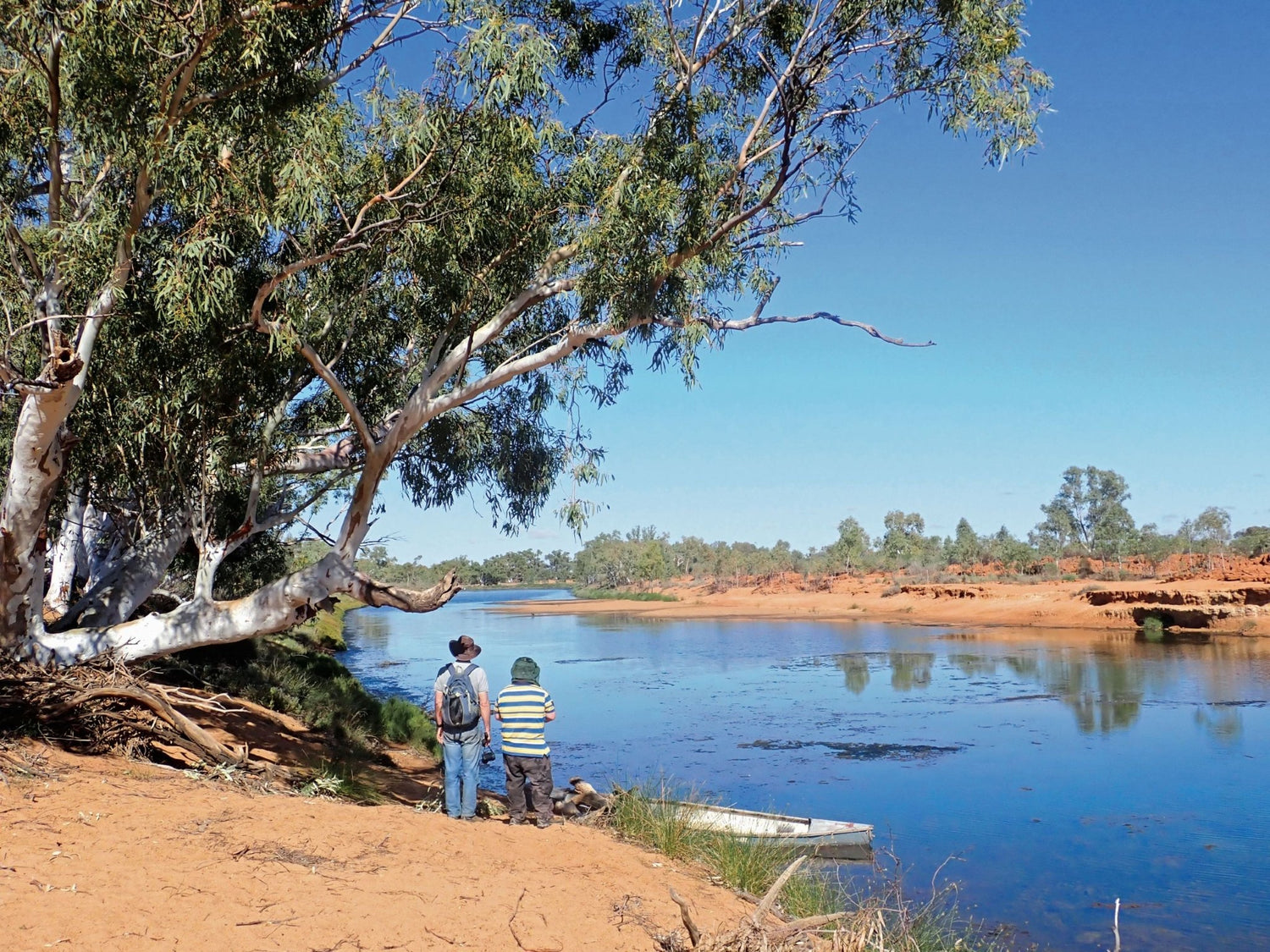
Ballinyoo Bridge, Murchison— history meets riverbank camping at WA’s second-oldest concrete bridge (built in 1932). The site now makes a prime stopover, where interpretive panels explain the bridge’s story. There are picnic tables, plus it’s an ideal spot to launch a kayak or take a dip in the Murchison River. Wildflowers burst into colour in season. If you’re into birdwatching, be sure to keep your binoculars within easy reach.
Jundoo Dam, near Sandstone— steam trains once drank deep from this dam, completed in 1910 at the tidy sum of £5,000. That’s three-and-a-half million gallons of water — a lifeline for the Goldfields rail network. Today, much of the original structure still stands. Keep your eyes peeled for the locals: emus strutting past, bungarras (sand goannas) sunbaking on the rocks and kangaroos bounding across the scrub.
Peace Gorge, Meekatharra— a local favourite for good reason, in neighbouring Shire of Meekatharra. Peace Gorge is the sort of place where you roll out the picnic rug, kick back among sculpted granite boulders, and just… breathe. Wander the reserve — wildflowers, native shrubs and hardy desert vegetation put on a show after good rains. The rocks off the opportunity for ambitious types to (carefully!) scramble up for sweeping views across the red-earth horizon. Make sure your fridge or cooler box are well stocked with beverages and have your coffee mug at the ready too — there’s no pub or café here, just pure bush quiet.
Errabiddy Bluff, Murchison— North of the tiny Murchison Settlement lies a peaceful hideout. Errabiddy Bluff has room to camp, with a flat, cleared space right near the Bluff. There are no facilities so bring everything, including your shade. The canopy of stars overhead at night is unforgettable. In a quirky touch, someone once installed a barbecue here; it must surely be up there in the running for winning the Most Remote Barbecue in Australia Awards (if such awards were to exist!). There’s no marked path to the top, but that’s half the charm. Winter is the sweet spot — cool nights, clear skies and not a soul around.
Wooleen Station — Wooleen’s bush camps provide an authentic outback stay, but terrain is natural with loose sand, uneven ground and manual stock gates. No paved paths exist and facilities require travel across open country. For more information, click here.
Other camping options include Murchison Oasis Roadhouse, Cue Tourist Park, Alice Atkinson Caravan Park and free camping at Lake Mason Homestead in Lake Mason Conservation Park.
So, whether you’re climbing granite outcrops, chasing wildflowers or soaking in river views, the Murchison region is well worth slowing down for. Mark these spots in your Hema Where to Camp Guide before you roll out — they’re the kind of detours that turn a trip into an adventure.
The real drawcard
So why go? Because the Murchison is WA unplugged. It’s history you can walk through, skies so clear you’ll trace the Milky Way end to end, and waterholes where you’ll likely be the only camper.
And because the Murchison feels like WA before the crowds. It’s about gold rush history, ancient culture, outback hospitality and landscapes that sprawl forever.
It’s the kind of place where you’ll find a waterhole to yourself, watch the Milky Way unspool across the sky and wonder why more people aren’t here.
Related articles
Hema’s guide to outback travel and survival
Top 5 Things to Rescue Your 4WD from a Sand Trap
Maps
Mid West Western Australia Map
Western Australia Road & 4WD Track Atlas


