
Guide to the Oodnadatta Track
Andamooka is a town of surprises. First, we were greeted with a pleasant, budget-friendly campground as we entered, before some locals made time to chat with us and tell us the best places to visit. While it is a small outback town, there are several interesting historic features focused on the boom opal mining period. For the more adventurous, there is a route from Andamooka across to Farina Ruins if road conditions permit. From our perspective, this is a highly recommended detour.
As we expected, the weather stayed fickle and so our plans changed a little, next taking us to Port Augusta. We stayed at the Port Augusta Motorhome Park, adjacent to the local footy ground where we took advantage of a hot meal and soaked up the atmosphere of post-game awards and speeches after the weekend’s round.
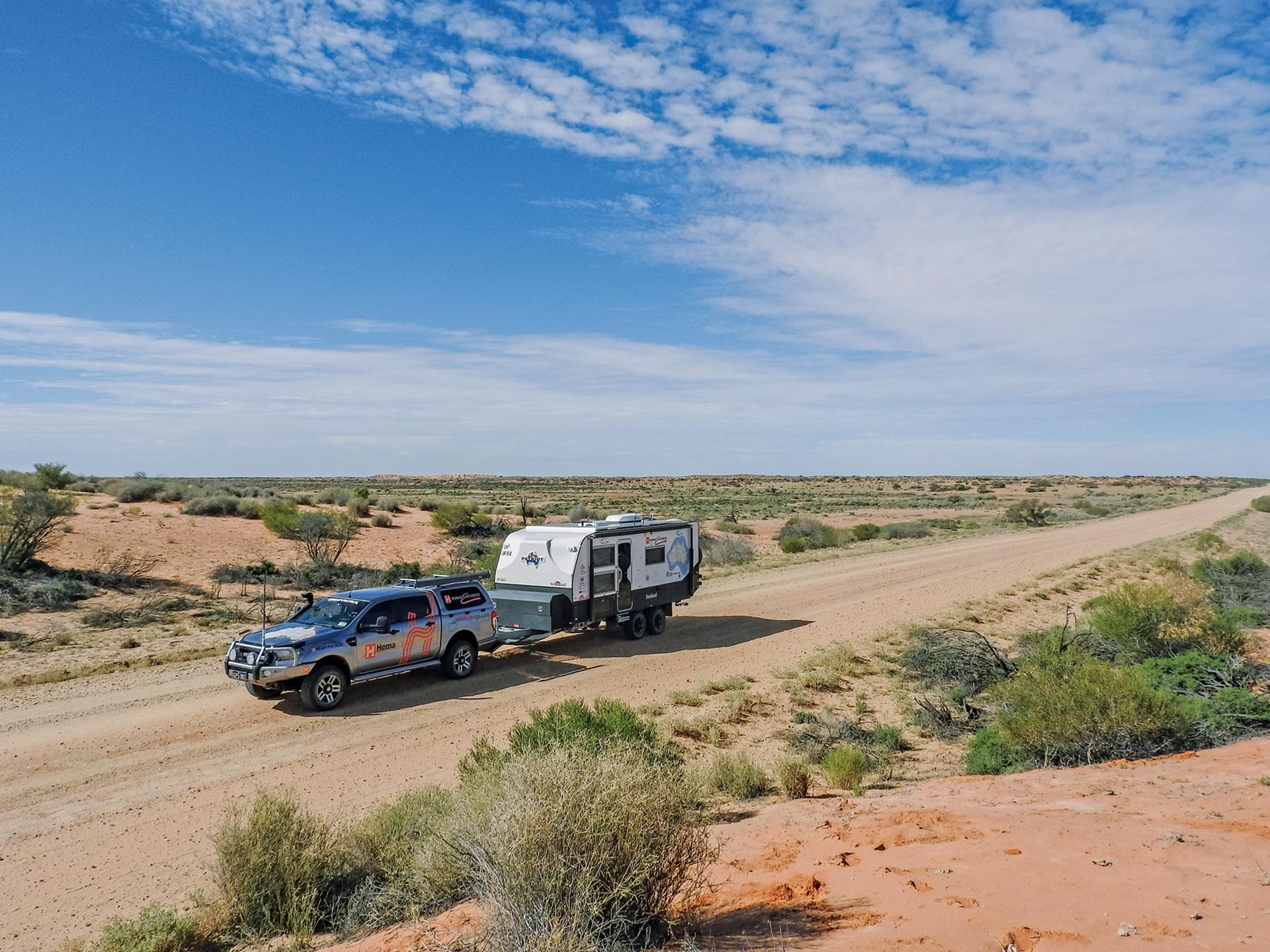
Finally, headed back into the red dirt country we love to rejoin the Oodnadatta Track — which follows the path of a traditional Aboriginal trading route that was used for thousands of years and travelled by notable explorer John McDouall Stuart — we passed through Coober Pedy and took the Coober Pedy to William Creek Road.
William Creek is a hive of activity: we met Andy from Adventure SUV, a group on a Variety Club Bash, a Great Divide Tag-Along Tour and an Outback Spirit Bus Tour, not to mention many solo and group travellers. Our fellow travellers shared a wealth of information both on travel and how they use navigation products, giving us plenty of product ideas for the future. We also assisted some Hema Navigator and App owners, before then lending our assistance in mending a motorhome water tank. It felt good that we were providing the solution rather than the problem this time.
To ensure we didn’t miss a beat, after leaving William Creek we turned right and started from the same point we had left off before the weather interrupted us: Bopeechee. Shortly after rejoining the track, our first stop was at the Lake Eyre South lookout. While the water is not in sight there at the moment, the vegetation and landforms are very interesting, not to mention being able to say we stood on the edge of Lake Eyre. After this minor detour, it was at last time for us to push on and experience the Oodnadatta.
The Oodnadatta Track follows the route of the Old Ghan Railway Line as well as the Overland Telegraph Line. We stopped at several of the ruin sites along the way, the first being Curdimurka. Having heard only good things about Coward Springs, we made this our next overnight camp. With a natural spa, restored engineer’s cottage and lush vegetation, as well as private campsites dotted between the trees, this was a great choice. The owners have gone to great lengths to erect facilities using the old sleepers, including a donkey shower and everything else in keeping with the location. We will definitely linger longer at Coward Springs next time we pass this way.
Beresford Siding Ruins also boasts a wetland with more prolific birdlife than we had so far encountered along the track. Our highlight, however, was Strangways Conservation Park. One of the geological features of the region is strings of mound springs. We could have spent several hours just at this one place with its multitude of walking tracks, while the views from the hilltop were outstanding and a good place to contemplate life.
Before William Creek, there is a Public Access Road to Lake Eyre North, more specifically ABC and Halligan Bays. This is a very rough track and is definitely not for caravans. We took the Ranger out to ABC Bay, which took around five hours for a 100km return trip. A Parks Pass is required but can be purchased via an honesty box at the start of the access road (track). After taking our time and enjoying the sights on offer, we decided ABC Bay was enough for us, declining a further 10km each way to Halligan Bay.
Heading back through William Creek, we came into new terrain once more. The track is mostly in very good shape, however, there are huge gouges in some areas, evidence of vehicles passing too soon after the recent heavy rain. With springs alongside much of the track and conditions changing constantly, vigilance is important. The track into Old Peake Ruins is not maintained and would have required several hours without the van, so we bypassed this and left it for next time.
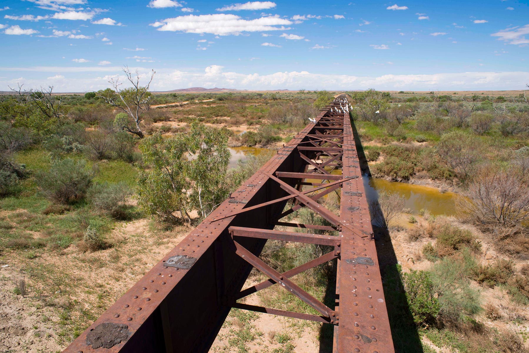
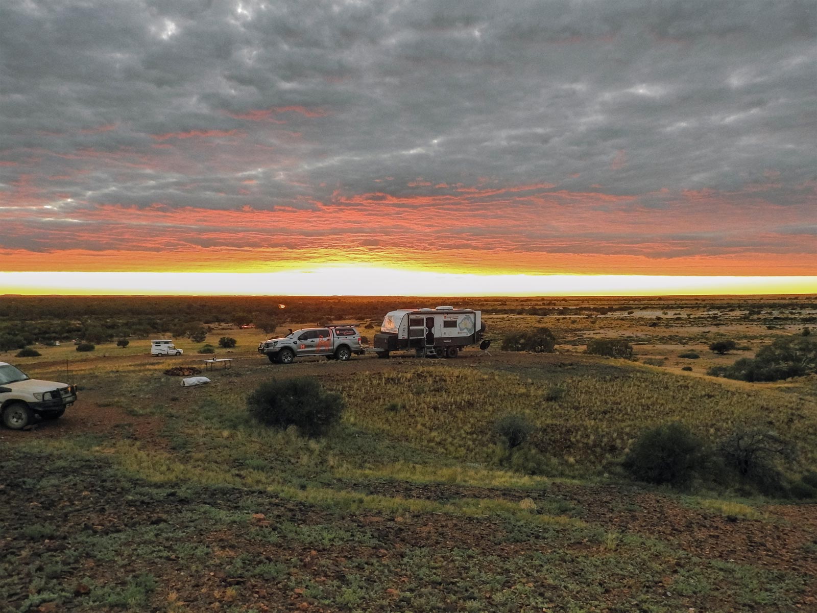
Our last overnight before Oodnadatta was spent high on a hill at Algebuckina Bridge. Algebuckina Waterhole has never been dry in recorded history and the mozzies certainly know that. It is well worth the discomfort to spend a night with such expansive views, taking in nature and some engineering in the middle of nowhere. We enjoyed the company of a young family who we had now met at four locations. Stan and Laura are homeschooling their 11-year-old twin daughters while discovering Australia for 12 months, and we enjoy each other’s company whenever we come together. As we sat around the campfire swapping stories, we could think of nowhere we would rather be.
Heading into Oodnadatta with rain in the distance, we opted to drop the van at the iconic Pink Roadhouse and make a day run out to the Painted Desert. This is every bit as amazing as any picture you might see, despite being overcast and not as colourful as it would be at sunrise or sunset. The track is not made for caravans, but a good camper trailer could definitely traverse the part we travelled on (as far as the walking track into the hills).
![]()
Oodnadatta Track Navigation & Maps
Hema Tours
If you can’t muster a ready-made convoy, join Hema Tours for a 4WD tag-along tour, full of adventure and discovery. Hema Tours are powered by the Adrenalin Offroad Centre, licensed commercial tour operators. Find out more here.
Next steps
At Hema Maps, we strive to provide the most comprehensive and accurate maps and guides for outdoor enthusiasts looking to explore Australia's natural wonders.
Did you find this information useful? If so, please share it with your fellow explorers. Whether it's by sms, social media, or email, your friends and fellow adventurers will appreciate the valuable tips and insights we've shared.
1 comment


Is there accommodations if we don’t have a van