Tasman National Park offers spectacular hiking trails, natural highlights and phenomenal coastal scenery complete with towering dolerite cliffs and pinnacles.
Essential information
| Location | Tasman National Park is located on the Tasman Peninsula, a 90 minute drive (56km) from Hobart. |
| Best time of year | The best time to visit the Tasman National Park is during the summer months, which is December to February. This period is also the peak tourist season. |
|---|---|
| Weather | The weather is warmest during the months of December to January, where temperatures range from 20 degrees Celsius to 22 degrees Celsius. Since the climate fluctuates so widely along the peninsula, it’s important that visitors check weather conditions before travelling. Winters tend to be windy, wet and cold. |
| Fees & permits | A valid park pass is required. View National Park Passes on the Tasmania Parks & Wildlife Service website for options and prices. |
Map
Navigation
Camping
There are two camp sites and caravan sites in Fortescue Bay. Bookings are compulsory from November through to Easter, however it’s recommended that you book your site any time of year. Tent and caravan sites available, no powered campsites. Additional fees payable. Some mobile phone reception in specific areas. A couple of free gas barbeques available for use and campfires are provided. Additional charges for firewood and hot showers. Bring your own water or boil water available at campgrounds. There is an on-site caretaker. Take your rubbish with you. See camping fees and campground layouts.
| Camping area | Site details |
| Banksia Campground, Fortescue Bay | 17 tent sites, 7 van sites. Information booth, woodshed, water tank, toilet and shower block. |
|---|---|
| Mill Creek Campground, Fortescue Bay | 4 tent sites, 19 van sites. Woodshed, toilet block, water tank and boat trailer parking. |
 Bushwalking and hiking
| Walking Trail | Details |
| Three Capes Track | The Three Capes Track is a 46km hike across the south-east wilderness of Australia. Visitors are treated to a variety of natural wonders, including timber boardwalk, migratory whales and an old Eucalypt forest. All the while, visitors are accompanied by the Tasman Sea. Visit www.threecapestrack.com.au for more information. |
|---|---|
| Devils Kitchen Car Park to Waterfall Bay | The Devil’s Kitchen Car Park Walk will take travellers across a distance of 1.7km. The self-guided walk will take visitors across the clifftops and allow them spectacular views of the Tasman Sea. |
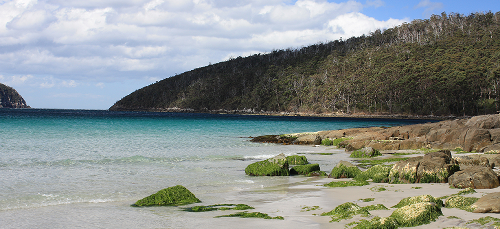
| Fortescue Bay to Canoe Bay | The Fortescue Bay to Canoe Bay walk is a moderate grade hike that spans a distance of 4km. The Canoe Bay walk follows the Tasman Trail, allowing visitors wildlife views, as well as a view of the Canoe Bay shipwreck. |
| Fortescue Bay to Cape Hauy | This hike through the Tasman National Park is a well formed track that will transport visitors to the very end of Cape Hauy. This destination has been chopped up into two islands, called Candlestick and The Lanterns. The walk offers both ocean views and sandy beaches. |
| Waterfall Bay to Fortescue Bay | The Waterfall Bay to Fortescue Bay walk offers one of the most breathtaking views in Tasmania. This is a 16km trail that takes 7 hours to complete, one way and so transportation to the area is imperative. The trail offers not only spectacular cliff views, but also a waterfall. |
| Cape Raoul | Cape Raoul is a 14km return walk that takes visitors through the Tasman National Park. The journey is a comfortable one that offers views of spectacular coastal scrub, as well as views of a seal colony situated at Cape Raoul’s base. |
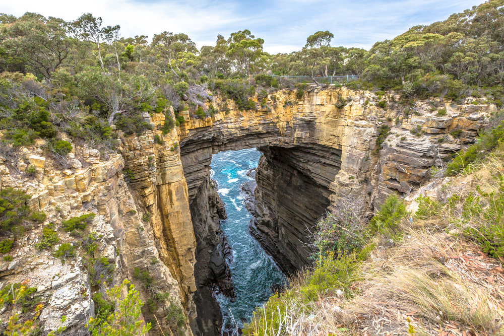
Tasman Arch
The Tasman Arch is an area of stunning natural beauty and it’s only a short walk from Pirate’s Bays. This intriguing stone arch offers astounding views of the Tasman coast, located to the south. Location: 16/20 Tasman Arch Rd, Eaglehawk Neck, Tasmania.
 Remarkable Cave
The Remarkable Cave is well named because when it is seen from the observation platform, it takes on the shape of Tasmania. Location: 446 Safety Cove Rd, Port Arthur, Tasmania.
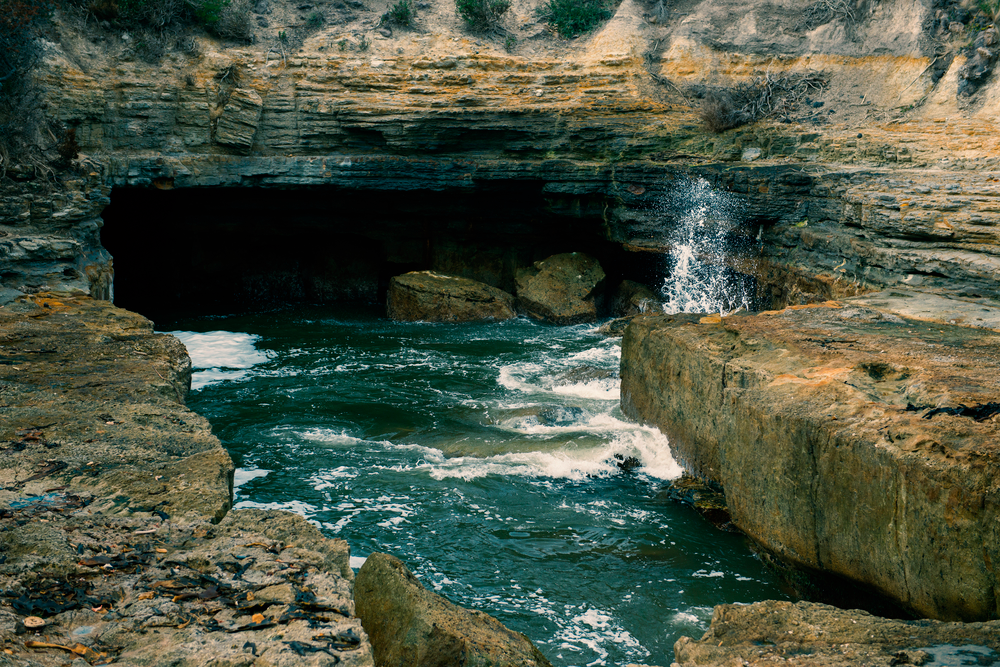
Tasman Blowhole
The Tasman Blowhole is another extraordinary geological formation situated in Tasman National Park. This natural wonder is situated only 1,5 hours from Hobart and offers visitors impressive views of the surging ocean. Location: 336 Blowhole Rd, Eaglehawk Neck, Tasmania.
Tessellated Pavement
The Tessellated Pavement is a geological formation of square rocks that appear to have been laid down by a man’s hand, in much the same way as pavement. Visitors only have to walk for a few minutes to be offered a breath taking view above this natural wonder. Location: 380 Pirates Bay Dr, Eaglehawk Neck, Tasmania.
Cape Pillar
Cape Pillar boasts rising cliffs of more than 300 metres and offers visitors the very best views of Tasman Island, including its cliff edges. Other thrilling Capes can be seen from the cliffs of Cape Pillar, making the views just about second to none.
The Candlestick, Cape Hauy
The Candlestick is a dolerite rock formation that is situated in Cape Hauy. Not only is the formation a sight in itself, but the trails in this area allow visitors to see the coastline from multiple viewing points.
Totem Pole, Cape Hauy
The Totem Pole is another dolerite rock formation that sticks out of the ocean at Cape Hauy and this natural wonder can be accessed by hiking or by cruise.
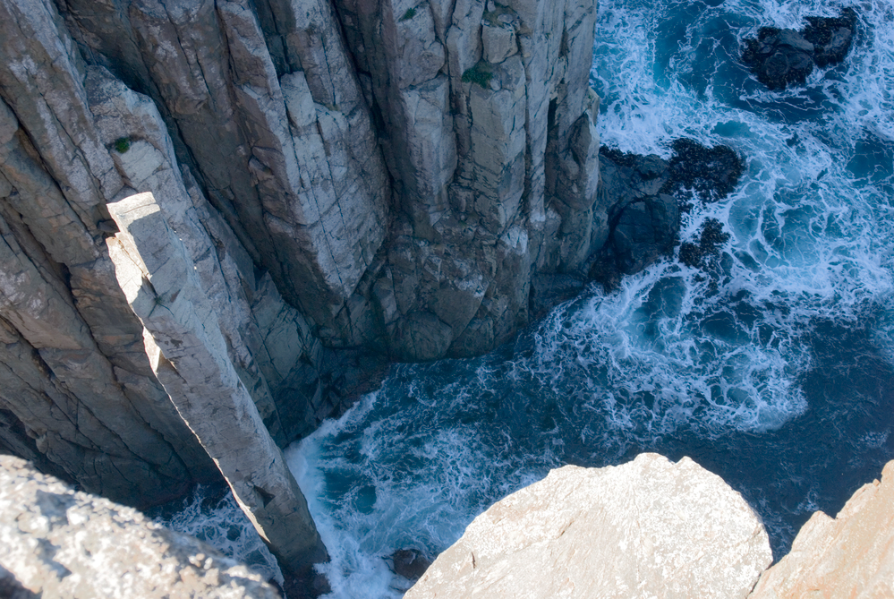
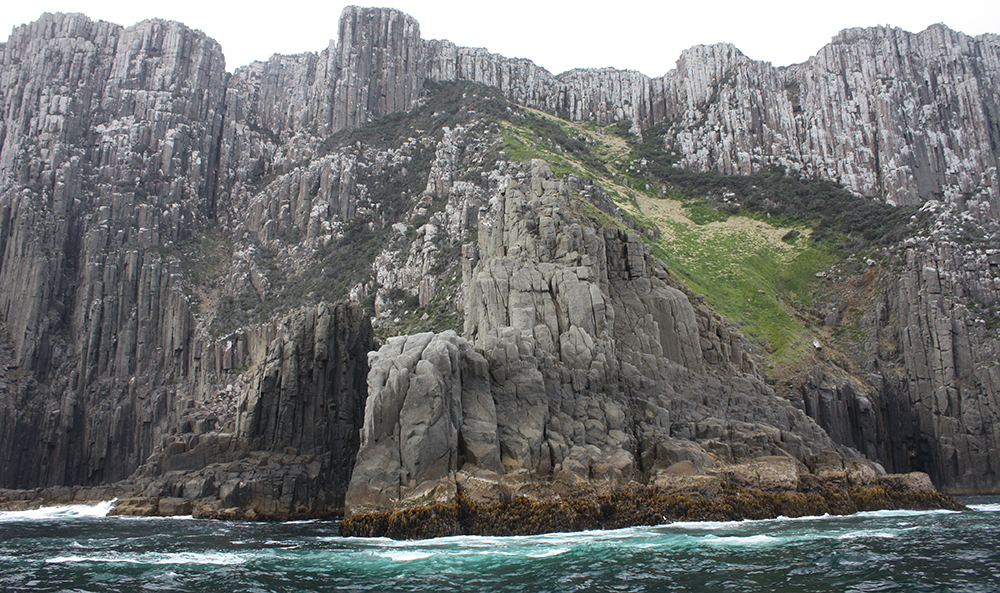
Dolerite Cliffs, Cape Raoul
The Dolerite Cliffs at Cape Raoul are large columns of dolerite that extend down from the cliffs, into the ocean. These cliffs are perhaps best views at sunrise and sunset, when they take on a yellow glow.
Port Arthur Historic Site
No visit to Tasmania is complete without a trip to the former convict settlement at Port Arthur, Australia’s most famous convict settlement.
Important Contacts
Tasmania Parks & Wildlife Service
Phone: 03 6250 3980
Fortescue Bay campground bookings: 03 6250 2433
Our Recommendation
“Although travelling the Tasman National Park by road was really enjoyable with plenty of highlights, for me the best way to take in the sheer beauty and size of the magnificent Tasman Peninsular coastline was by boat. I was lucky enough to go on a boat cruise and I was in awe of the massive cliff faces, breath taking scenery and the boat even went into some of the caves.” - Kirsteen Kennedy, Hema Maps.