Hiking & Bushwalking - Victoria's High Country
Victoria’s High Country offers plenty of opportunities for bushwalking, whether you are an experienced hiker looking for a new challenge or merely wanting to take a stroll. In most cases, walkers should be reasonably fit in order to cope with the rugged terrain and occasional extreme weather. Mobile phones rarely work in such remote areas, and you should never set out in bad or deteriorating weather.
The region is crossed by well-known long distance walks including the Australian Alps Walking Track and the Bicentennial National Trail. Both trails are suitable for keen hikers and require significant forward-planning to complete in their entirety, however more casual walkers may opt to tackle smaller sections.
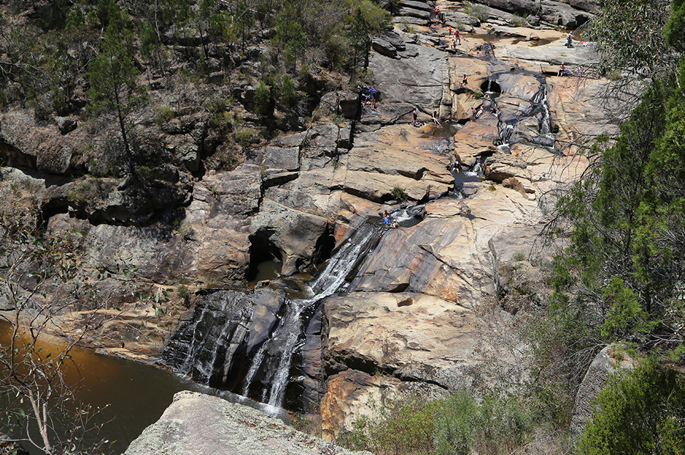
 Image: Woolshed Falls, Beechworth
Taking two weeks to complete, the McMillan’s Walking Track is the slightly less strenuous option. The Murray to Mountains Rail Trail from Wangaratta to Bright is suitable for cyclists as well as bushwalkers. Challenging walks allow the fit and healthy to tackle the trek up Mount Hotham to Mount Feathertop in Alpine National Park. Or, if you are very fit and experienced, try the spectacular walk from Mount Hotham to Mount Feathertop via the Razorback Spur.
Popular short walks in Alpine National Park include Bryce Gorge Circuit (2.5hr), Peppermint Walk (1.5hr) and Howqua Heritage Walk (1.5hr).
Just south of Bogong Village, the new Fainter Falls Track is an easy 700m walk to two lookouts with great views - the more energetic can continue a further 200m down a steep track to the base of the falls.
Near Bright, the Canyon Walk along the Ovens River and the walk to Wandiligong along Morses Creek are both worthwhile. In Beechworth there are several historic walks around the town.
Mount Buffalo National Park is home to about 90km of walking tracks with everything from hard uphill slogs, such as The Big Walk, to shorter walks like the one-hour easy trip around the top of The Gorge. Other popular 'easy' walks include Eurobin Falls and the stroll around Lake Catani. The climb to the peaks of the Horn and the Hump is another 'must do'.
The Australian Alps Walking Track
The Victorian Alpine Walking Track starts in Walhalla and extends for 650km through the Victorian Alps all the way to Canberra. The High Country section of the track provides hikers with some of the best scenery the High Country has to offer. About six weeks is required to complete the entire journey. Walkers should be entirely self sufficient and prepared for climatic changes. For further information visit Australian Alps National Parks.
McMillan's Walking Track
Running from Omeo to Woods Point, McMillan's Walking Track follows a former mining track blazed by Angus McMillan in 1864. The object of the original track was to open up new areas for prospecting. Its intention was realised when a track-cutting party discovered gold at Talbotville. The track was officially reopened as a walking track in 1988. You'll need to allow two weeks to complete the entire 220km walk and it is only suitable for experienced walkers.
Bicentennial National Trail
Established in 1988, the Bicentennial National Trail is the longest marked multi-use trail in the world stretching 5,330km from Healesville to Cooktown in Queensland. It passes through some interesting and scenic country between Healesville and Omeo during a 443km section before penetrating the country beyond Omeo into the Snowy Mountains. The trail, originally known as the National Horse Trail, follows old coach roads and stock routes once used by bushrangers and cattlemen alike. Although the track is now aimed at walkers and cyclists as well as horse riders, the distances involved make it generally more suitable for riding.
Intended users of the trail are reminded to be aware of potentially harsh conditions at any time. The best time to do the Healesville to Kosciuszko section of the trail is from November through to mid-April. For further information visit The Bicentennial National Trail or contact 1300 138 724.


0 comments