


Ever wondered how Hema maps are made? We had a chat with our fieldwork guru Bryce to ask how the Map Patrol gets in info in the field.
Q.What's your role at Hema?
I am the Fieldwork Administrator and a Geographical Information Systems (GIS) analyst as part of the Hema Maps GIS team.
Q.Everyone's probably wondering how they get a job like yours; what's your background and how did you end up in the driver's seat of the Map Patrol?
A question I get regularly in the field! Prior to being with Hema, I was in the mining/exploration sector for approximately 8 years. I worked with exploratory geophysical survey in predominately remote locations throughout Australia and overseas, utilising numerous types of data collection software, hardware and off-road vehicles.
How I ended up in the driver’s seat? You have to be extremely lucky and have impeccable timing when landing a job such as this, so I count my blessings every day! All I can say is cold calling/cold emailing can actually work!
On top of my experiences working in the bush and keenness for getting out in the there 4WD’ing, for me to secure a seat in the driver’s seat of the Map Patrol it was vital to hold an undergraduate or postgraduate degree in GIS. This gave me a solid basis in terms of understanding the fundamentals of GIS data but also understanding GIS software for integration of data through to cartographical visualisation of said data in map products.
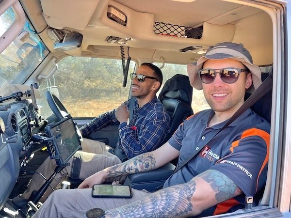
Q.Give us a quick explanation of how the Map Patrol collects information.
The “Map Patrol” currently utilises a Toyota 79 series Landcruiser modified mainly for long-range touring. On the data collection side of things, data is collected using an off-the-shelf third-party mobile GIS data collection app along with high precision/accurate DGPS hardware to ensure data collected has sub-metre accuracy. The Map Patrol seeks to collect brand new road/track data & Points Of Interest (POIs), as well as keeping existing road/track and POIs data as up to date as possible.
Q.Briefly, how does the information you collect go from being data to a map?
Once a field trip is completed, the data is synchronised up to the cloud for the GIS team to download. The team then begins processing this raw data. The raw data is tidied, geometry and attribution information are checked and the dataset is readied to be integrated into the master database. Using newly created algorithms, the field data integration is mostly an automated process. Once integrated, this data is ready to be used in all future Hema associated map products and app updates!
Q.Presumably, this year hasn't been great for fieldwork, how has Hema adapted to keep things up to date in these tricky times?
Yes, nationwide closures of borders due to COVID have impacted Map Patrol fieldwork severely throughout most of this year. To tackle this lack of fieldwork and subsequent data collection, we have been using a more focused approach to obtaining field data from external third-party sources. As part of this, we have designed and begun rolling out an incentivised data collection program which involves a hand-picked group of what we are calling “Alpha” users, who have been trained and supported by Hema to collect new and updated data. Currently, in this phase of the program, these users are based in QLD, TAS and WA, with the idea to scale up to have users in each state.
Q.If the big bosses gave you a blank cheque to set up a new Hema Map Patrol, what would be your base vehicle and how would you kit it out?
It’s a tough one as you could go a few ways, but currently, it would have to be another 79 series; however, modified to the version we currently have. Toyota has a proven track record of being reliable in the bush and parts are certainly a lot easier to come by when you are remote – which is a big advantage! Kit wise, much in the same vein as the current 79 series; GVM upgrade to 3950 kg, 2- to 3-inch lift, heavy-duty leaf springs, adjustable remote reservoir shocks, 34-inch tyres etc.
The difference would be looking at choosing a lighter weight canopy reducing weight at the rear but also bringing the spare tyre mounts closer into the rear axles, reducing that potential swing in the bum end. In addition, enough drawer space for only the essential tools/parts and a BM system capable of running auxiliary power source for fridge and 240v outlets. Essentially, I would be looking to build a rig that would be capable of tackling tough tracks and long-range touring but with the ability to carry the essentials with load weight to spare.
Q.Where’s the Map Patrol heading next?
The planning for the next Map Patrol trips so far are looking at the Great Desert Tracks (GDT) and Nullarbor region of central and southern Australia for mid-2021. The GDT trip will also be used to celebrate the 21st anniversary of the Map Patrol!


