


Words Julija Zivanovic Pics Supplied
We’re witnessing a once-in-a-generation event in the outback currently, with floodwaters from recent heavy rains in Queensland’s Channel Country flowing to other parts of the country for the first time in decades. We take a look at how flooding in the desert affects the environment, touring and local communities. Keep reading to learn more.

Only the fourth time in 160 years have we seen flooding like this in Australia’s arid interior, and with it has come an explosion of life. What is usually arid and desolate has come alive with flowing water, wildflowers, birdlife, aquatic life and much more. Despite these incredible natural developments that have come from the record-breaking rainfall, there has been just as much destruction to local communities, and especially farmers, which we cannot overlook — more on this below.
We look at how recent flooding because of enormous rains in Queensland and New South Wales in early May 2025 have created record flooding in the Cooper Creek System and significant rains in the Diamantina River Catchment. This has affected the downstream country, including the environment, natural landmarks, touring and local communities.
Kati Thanda–Lake Eyre
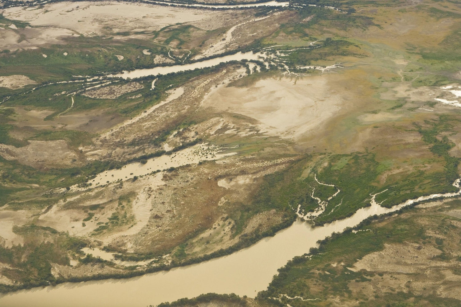
The most heavily affected interior lake is the massive Kati Thanda–Lake Eyre in South Australia which covers 9500 square kilometres at Australia’s lowest point: 15m below sea level. It’s currently undergoing an incredible transformation as floodwaters from recent heavy rains in Queensland’s Channel Country fill the normally dry salt flats. The extraordinary nature event is attracting all sorts of nature lovers, including birdwatchers, photographers and outback tourers.

If you’ve not seen a desert area come back to life after decades, then we recommend planning a trip to SA’s normally arid interior. The incoming flood waters have completely revitalised the salt crust and surrounding environment, causing a domino effect through nature’s processes. It starts with tiny brine shrimp hatching from eggs laid in the parched lakebed, attracting fish that then spawn and feed on them, while vast numbers of water birds are flocking to the area in large groups to feed and breed. Notable species include pelicans, banded stilts, gulls and even migratory species coming from as far as China and Japan to participate in this spectacular event. Meanwhile, desert wildflowers bloom, adding bursts of colour to the usually desolate landscape.
Check out the full lake!
Kati Thanda–Lake Eyre National Park is jointly managed by the National Parks and Wildlife Service South Australia and the Arabana people — the Traditional Owners of the land. Access points for visitors typically include the small outback towns of Marree and William Creek. If you’re hoping to view this once-in-a-generation nature event, we recommend careful planning, and the best view is from above which is best accessed by a scenic flight or from a viewing platform such as Halligan Bay Point.
There are plenty of camping options in the area, one of which is Halligan Bay Point Campground with limited amenities such as toilets and picnic shelters (four-wheel drive and tent camping only). If you’re travelling with a camper trailer or caravan in tow, there is the privately owned campground at Muloorina Station, north of Maree. Visitors are strongly advised to travel with a well-equipped 4WD vehicle (don’t forget your recovery gear), sufficient food and water supply. We also recommend the Desert Parks Bulletin to check for the latest weather and road conditions and you’ll need a Desert Parks Pass to visit.

Please also note that recreational activities such as boating, swimming, off-track driving and aircraft landings are prohibited under the National Parks and Wildlife Act 1972 to protect the delicate environment and cultural heritage.
For further information about Kati Thanda–Lake Eyre National Park, including camping details and access updates, visit parks.sa.gov.au.
Coongie Lakes
It’s not just the famous Kati Thanda–Lake Eyre which has been affected by these massive rains. The Coongie Lakes west of Innamincka, SA, are another beneficiary of when the system floods, with the area also exploding with natural life. Seeing the Coongie Lakes full like this could be a once-in-a-lifetime experience, so we recommend planning your next four-wheel driving road trip to or through this area.

Visiting the area to view the spectacular awakened nature for yourself is just one part of helping local communities rebuild post flood. The town of Innamincka was, unfortunately, closed off and cut off from tourism and the rest of Australia for weeks, so if you’re heading to see the Lakes, stop in the town for a feed and a drink at the Innamincka Hotel — an oasis in the middle of the rugged SA outback. Or fill your car and stay in a room at the Innamincka Trading Post.
At time of writing, long sections of the Birdsville Track and the Strzelecki Track remain closed, so you’ll need to plan your route to Innamincka accordingly.
Murray-Darling Basin farmers
Across the Murray-Darling Basin and through Queensland’s Channel Country, farmers have experienced a massive loss of crops and livestock. This has been devastating for farmers and their livelihoods, with estimates ranging from thousands to hundreds of thousands of cattle, sheep and other livestock lost due to drowning, starvation or injuries from being swept away by floodwaters. There has also been infrastructure damage throughout these areas, particularly roads, fences and gates — essential for farming operations.
 (Credit: Matt Williams)
Support local
It’s not just the farmers who are affected by this rare weather event as well — due to high water levels closing multiple arterial roads and four-wheel drive tracks, 4WD tourers haven’t been able to visit these areas, so local businesses in these areas have also suffered with no clientele. As the heavy rainfall dries up and these communities reopen, go give them a visit or pass through on your next road trip. They’ll appreciate you even if it’s just grabbing a meal and drink.
Cooper Creek Ferry
When the Cooper is flooding, the South Australian Department of Infrastructure and Transport operates a ferry/barge at the Cooper along the Birdsville Track, north of Mungerannie at Etadunna. After prolonged rainfall at times like this, the ferry might be needed to operate for 6–8 months. The ferry has not yet commenced operations this season (despite the Cooper flowing) and it is uncertain when it will be restored. It’s best to check the Department of Infrastructure and Transport’s website about its status before setting off.
Important note
If you are travelling in outback SA — including heading to the Birdsville Races in early September — before the barge has reopened, please remember to:
Plan ahead using an alternative route
Monitor weather reports and flood warnings
Drive to the conditions
Avoid travelling in or through flood-affected areas
For the latest information on road conditions and flooding impacts, check the interactive map here.
Related articles
Central Australia — Through a Land of Myth and Legend


