A Product Overview of the High Country Victoria Atlas & Guide (3rd Edition) from Hema Maps
 (Image: The High Country Victoria Atlas & Guide 3rd Edition from Hema Maps.)
The High Country Victoria Atlas & Guide (3rd Edition) is Hema’s best-selling guidebook for discovering the magnificence of the Victorian High Country.
This definitive Atlas and Guide features the Top 30 4WD Trips for the High Country, as well as the best regional campsites, adventure activities and trip planning tips written by ‘off-road legends’ Ron and Viv Moon (who have been writing guidebooks for 4WD travellers on remote areas of Australia since 1985) in combination with premium topographic Hema atlas mapping for the region.
This edition of the guidebook features 40 atlas pages at a large scale of 1:150 000 in a stunning cartographic style, including the latest mapping of the region, points of interest (POIs) and facilities that have all been field-checked by the Hema Map Patrol team.
 (Image: Victorian High Country Atlas & Guide, preview of atlas maps 37 & 38 from Hema Maps.)
Also included is an introduction to the region, spectacular imagery highlighting some iconic Points of Interest (POI’s), important information sections on planning the trip and what to see and do in the region. There are detailed touring sections on the distinct regions of the High Country, including the Great Alpine Road, Alpine National Park as well as Snowy River and Baw Baw national parks.
 (Image: Cropped close up of the region mapping detail in the atlas maps in the High Country Atlas & Guide from Hema Maps.)
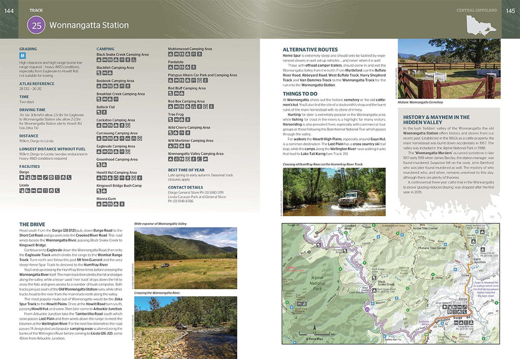
The Top 30 4WD Trips featured in the High Country Victoria Atlas & Guide are broken into their respective localities, with each trip containing comprehensive trip information, including gradings, distances, relevant travel information and drive coverage from start to finish.
 (Image: A preview of Track 25- Wonnangatta Station pages 144-145 of the VIC High Country Atlas & Guide from Hema Maps.)
Key Product Features-
- Top 30 4WD trips of the High Country
- Detailed High Country Road Atlas
- 40 atlas pages at a scale of 1:150 000
- Detailed inset maps for each 4WD trip
- Maps show fuel stops, camping areas and rest areas
- Plus best campsites, adventure activities & trip planning tips
Product Details-
- Edition: 3rd
- Publication Date: 1/04/17
- Scale: Various (Atlas mapping 1:150 000)
- Binding: Spiral
- Number of Pages: 208
- Size (W x H x D): 2155mm x 297mm x 15mm
- Weight: 0.955kg
The High Country Victoria Atlas & Guide is currently available at the Hema Maps store for AUD $49.95 and can be purchased now by clicking HERE, or via the following link-
https://shop.hemamaps.com/collections/victoria/products/victoria-high-country-atlas-guide
For more atlases, guides and map products of the Victorian High Country from Hema Maps, you can view them by clicking HERE, or via the following link-
https://shop.hemamaps.com/collections/high-country-vic
For more atlases and guides from Hema Maps, you can view the collection by clicking HERE, or via the following link-


0 comments