
:
Ingeegoodbee
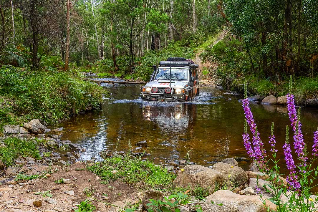
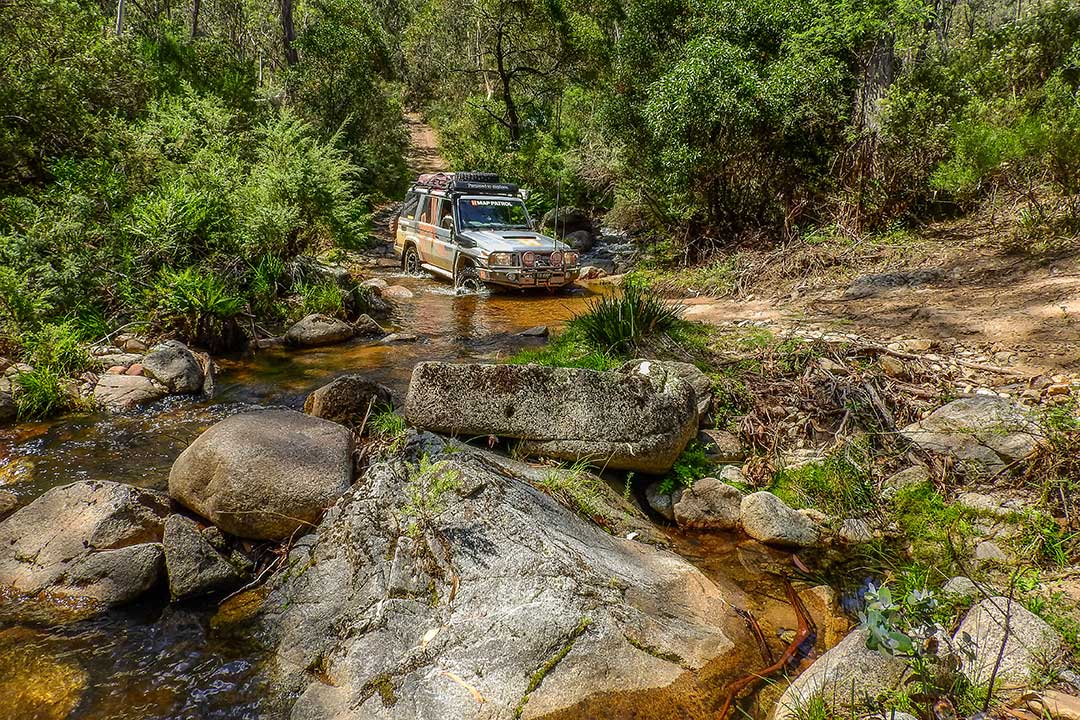
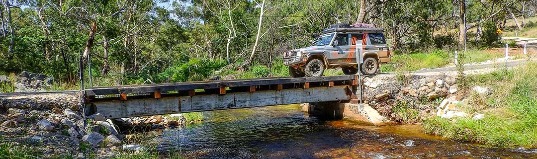 Travel up the Ingeegoodbee and you will soon be in pure four-wheel driving country. You're going to need to exercise every bit of your four-wheel drive experience on this run.

4WD Pack

Hema HX-1 Navigator
| Grading | Difficult. Low range and high clearance |
|---|---|
| Time | 1 day |
| Distance | 99km |
| Longest drive without fuel |
163km Gelantipy to Omeo; one-day endurance in heavy 4WD conditions required |
| Fuel & supplies | Benambra (no fuel), Buchan, Gelantipy (Karoonda Park), Omeo |
| Best time of year | Summer, although not in rainy weather |
| Warnings | This track is impassible in wet weather. Most of these roads are also closed during winter, so check closures before setting out |
| Fire bans | Sections of Alpine National Park will be closed on Code Red (Catastrophic) days |
| Facilities | Benambra, Buchan, Gelantipy (Karoonda Park), Omeo |
| Important contacts | Snowy River Visitor Information Centre Ph (03) 6450 5600 or 1800 637 060 Omeo Region Information Centre Ph (03) 5159 1679 |
| Activities | Bushwalking, fishing, swimming |
The Track
North of Suggan Buggan is the start of the Ingeegoodbee Track. This 4WD trek leaves the Snowy River Road and follows the Ingeegoodbee Track up to the McFarlane Flat Track. These tracks are very steep and scrambly and would be impassable in wet conditions.
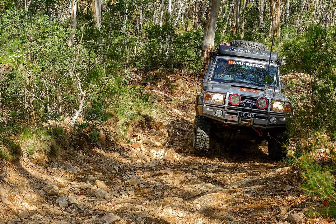 You will find the start of the Ingeegoodbee Track 6km northeast of Suggan Buggan. There are some excellent views as you climb the Ingeegoodbee, particularly at the helipad near Mount Menaak. Turn west at the McFarlane Flat Track and pass through the seasonal road closure gate. It is a steady, challenging drive to McFarlanes Flat. This track eventually meets the Cobberas Trail, which takes you out to Limestone Road. From here it is an easy run into Benambra over Beloka Gap.
Camping
Limestone Creek, Native Dog Flat, Susan Buggan, The Playgrounds bush camping area
 Things to do
If you're in the mood for a bushwalk, the Australian Alps Walking Track and the Snow Gum Trail split off from the Limestone Road, heading up into the Snowy Mountains past Moscow Peak and Mount Cobberas 1 and 2. From Suggan Buggan, it isn't far to see the Little River Gorge, the largest gorge in Victoria and Little River Falls. Check out historic sites around Benambra and Omeo, which were two of the first districts in Victoria to be permanently settled
The Ingeegoodbee Track
The Ingeegoodbee Track is one of the most important historic road networks in East Gippsland. It is associated with the rugged terrain and intrepid spirits of those who were the first to build permanent settlements in Victoria. The track was originally established as an Aboriginal pathway. As European colonisation increased in the 1830s, it became the major stock route for the movement of cattle from the Monaro district of NSW to East Gippsland.
 The Ingeegoodbee Track was essential to the economy of the East Gippsland and Monaro regions. It opened up the remote forests of the East Gippsland region to European occupation and provided a means of communication between early European settlements of East Gippsland and ones in the more established Monaro region. The track has an association with some of the greatest feats of cattle droving in the history of East Gippsland and is of interest to anyone who wants to explore the area's history further.


0 comments