
:
Condamine Gorge
 Guiding travellers through ancient Gondwana Rainforest nestled within the Great Dividing Range, Condamine River Road crosses its namesake 14 times, making it a perfect day-trip for adventure-seekers and nature-lovers.
Essential information
| Grading | AWD |
|---|---|
| Time | Day trip |
| Distance | 128km, Boonah return |
| Longest drive without fuel |
68km, Boonah to Killarney |
| Fuel & supplies | Boonah, Killarney |
| Best time of year | Fine all year but check road conditions after rain |
| Warnings | The Condamine Gorge can flood so check with locals before venturing into this area. It can also become very muddy at times. |
| Permits and fees | Fees apply for camping |
| Camping | Boonah Show Society Caravan Park, Killarney View Cabins & Caravan Park, Queen Mary Falls Caravan Park & Cafe |
| Important contacts | Killarney Area Promotions Association www.killarney.org.au QPWS, Department of National Parks, Sport and Racing Ph 13 74 68, www.nprsr.qld.gov.au/parks Boonah Visitor Information Centre Ph (07) 5463 2233, www.boonahtourism.org.au Warwick Visitor Information Centre Ph (07) 4661 3122, www.warwickevents.com Cambanoora Gorge Management Group www.cambanooragorge.org.au |
The drive
NOTE: The left-hand fork of the Killarney end of the Condamine River Road - called Brosnans Road - is local traffic only, meaning travellers are advised to take the right fork and head into Killarney after completing the track through the gorge.
Main Range comprises of several specific localities – of which the common ones are Cunninghams Gap, Spicers Gap and the areas around the Condamine River, Carneys Creek, The Head and Queen Mary Falls.
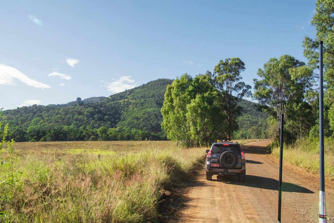
Although there are several areas where you can ‘off road’ as such, the main focus is the spectacular region comprising the Condamine River. Take the trip from Brisbane to Boonah, and make your way to Carneys Creek Rd until you reach The Head Rd on your second crossing of Teviot Brook. The bitumen road meanders through the foothills of the ranges until you finally start your steep climb towards the lookout of Teviot Falls.
Be careful as you travel through this scenic area, as the road is narrow and the drop off steep! Crest the climb and the valley of the Condamine River is laid out before you. Be wary of lazy cows that may cross your path as you meander down the lush green valley, passing farmhouses, and rusty cars.
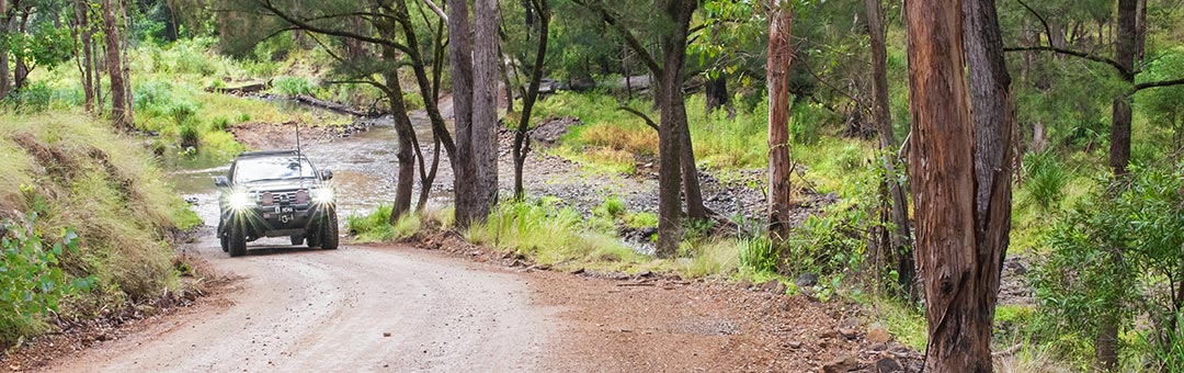
The road morphs into dirt and continues down to a turnoff to The Head. From here, continue down the valley where the fun of 14 river crossings awaits you!
The Condamine Gorge can flood at times so check local knowledge and information before venturing into this area. It can also become very muddy, so caution is required during your exploration. Normal four-wheel driving etiquette is required through this section where oncoming cars may cause hazards during river crossings, underwater obstacles (notably large rocks) can cause havoc to your vehicle, and splashed water can enter your water intake.
 Your adventure through the valley and river crossings eventually takes you to the small forestry milling town of Killarney from where you can explore other beautiful areas in the Main Range National Park.
There are numerous ways to make your return trip to Brisbane including the Cunningham Highway where you can stop to explore other parts of the park. There’s even some more dirt road driving at Spicers Gap. Other areas worth visiting include the Steamers and Emu Creek Valley which will require high clearance vehicles, and the beautiful mountains including Mt Barney, Mt Maroon, Mt May and the numerous dirt roads that connect these amazing areas.
Things to do
Away from the hustle and bustle of the cities and beaches lies some remarkable and seemingly untouched wilderness that is just crying out to be explored. Amazingly, so few people know of the beauty and fun that can be found in the Main Range National Park.
One of our lesser known parks, but known well within hiking and bushwalking circles, Main Range National Park stretches from Wilsons Peak in northern NSW up to Cunninghams Gap in south east Queensland.
Near the Condamine River, keep a watch out to your left where you may spot the old rabbit fence that was designed as a barrier between QLD and NSW. If you are a keen hiker, don your hiking boots and scoot up the rabbit fence to the amazing views at the top of Wilsons Peak.
After completing this trip most people take the turn towards Queen Mary Falls where some beautiful walks can be found.
Maps & navigation

4WD Pack

Hema HX-1 Navigator


0 comments