
:
The Map Patrol in the Simpson Desert
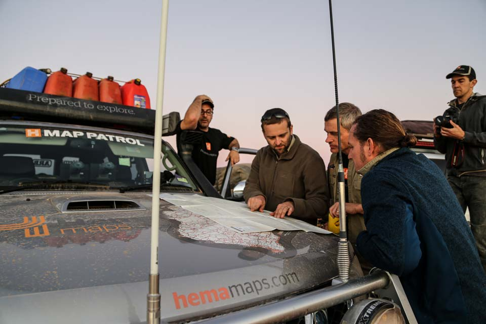
While the drive from Brisbane to the edge of the desert is a formality for the trip across the Simpson for Hema Maps, a feeling of adventure crept in as the team aired down to tackle the Birdsville Developmental Road. The scenery changed from Outback to distinctly desert, with red dirt everywhere and the landscape gradually simplifying as Birdsville drew nearer.
This trip would be a testing ground for capturing rich digital content like geotagged photos and video of Australia’s off-road regions, in addition to the Map Patrol’s normal track and point of interest logging. This information-intensive process saw travel times slow compared to a usual tourer, though resulted in more in-depth data than ever before.
Simpson Desert Navigation & Maps
4WD Pack

Hema HX-1 Navigator
Day 1 – Birdsville to Eyre Creek Bypass
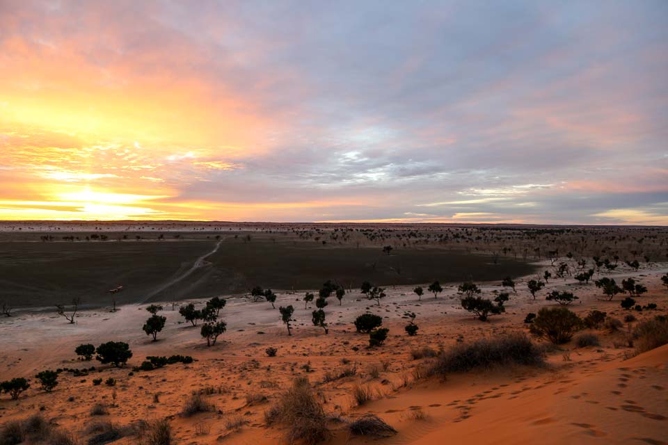
The team rose early, leaving the Birdsville Caravan Park to reach Big Red in time for sunrise. Also known as Nappanerica, Big Red rises almost 40 metres above the plains and is the first and largest sand dune in the entire Simpson Desert. Looking west towards what was to come, the rising sun turned the dunes a fiery red, reminding the crew to air down their tyres even further to 15psi to deal with the drive ahead.
 The tall dunes along the QAA Line were severely chopped on the western side from other travellers, the main culprit no doubt camper trailers getting dragged over each dune. This slowed the team’s travel, and coupled with the time consumed by mapping and data capture processes meant the team only got as far as Eyre Creek by day’s end. After driving up Eyre Creek Bypass for a time, the team found a clearing that hugged a dune, offering protection from the wind at night. Settling in with some dinner and a campfire, an early night was had to rest up for the next day.
Day 2 – Eyre Creek Bypass to Hay River Track
Getting up before sunrise, mandatory vehicle checks were done to ensure both Map Patrol vehicles were in perfect working order before a day of travel. Checking oil, water, transmission fluid, tyre pressures and air filters were done in addition to minor refuelling from jerry cans, checking everything strapped down was still secure and other minor checks. These checks occur each day as part of the Map Patrol’s daily ritual, after which it was time to continue along the QAA Line.
> Get a virtual tour of the QAA Line
 The state of the track was similar to the previous day, with the team reaching the end of the QAA Line before going north along the Hay River Track to do recon on shot lines, so as to find any navigable tracks that split off the original track. After a long day of travelling and intense map data collection, the Map Patrol crew found an isolated area to camp for the night and rehash the day that had been.
Day 3 – Hay River Track to the French Line
Retracing the end of the previous day’s driving, the Map Patrol made their way to Poeppel Corner, which is the convergence of the Queensland, South Australia and Northern Territory borders. Upon finding a glut of travellers near the iconic marker, the team took a break to chat and field questions regarding the Hema Navigator HN7 and its functions before moving on to the French Line.
> Get a virtual tour of the Hay River Track to Poeppel Corner
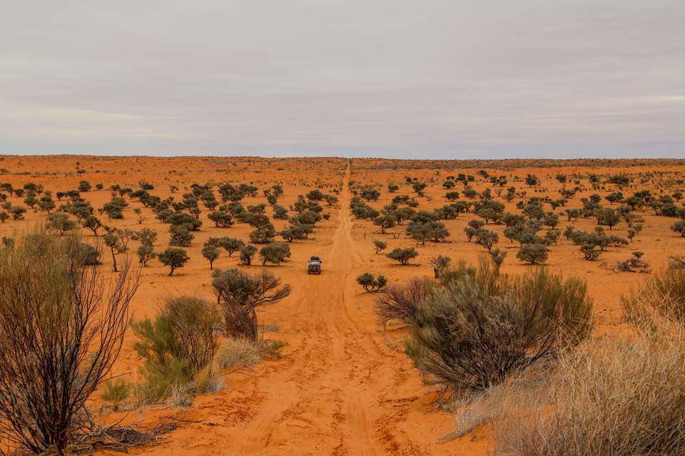
 The dunes on the French Line are smaller and closer together than those on the QAA Line, making the going easier and travel time faster. After 25km the team drove northwest to reach the abandoned Thomas Oil Well and do more track recon, before finishing the day at next to a quiet salt lake off the French Line. tar Setting up camp on the edge of the lake, a soccer all was pulled out and the flat ground the lake afforded became the perfect pitch.
Day 4 – Salt lake to the French Line
After a short drive south to meet up with the French Line once more, the Map Patrol continued west. Dunes got larger and larger as the day wore on, and the dream of reaching Dalhousie that day became futile. Day four in the desert finished with some cross-country driving to find an isolated bush camp, which ended up being around 10km east of the Colson Track. A hot dinner, a warm campfire and good company were the perfect end to another day of mapping the Simpson.
Day 5 – French Line to Dalhousie Springs
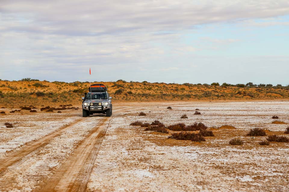
After another early start and morning rituals, the Map Patrol drove 90km to reach Purni Bore. The water from Purni Bore pours at near boiling, while the surrounding landscape has been formed solely by the permanent flow of water from the bore. After a short stop and airing tyres up to around 25psi on both vehicles, the team continued further into Witjira National Park and noted changing scenery, as the last small dunes of the Simpson Desert gave way to red dirt and tarmountain ranges in the distance.
> Get a virtual tour of the French Line
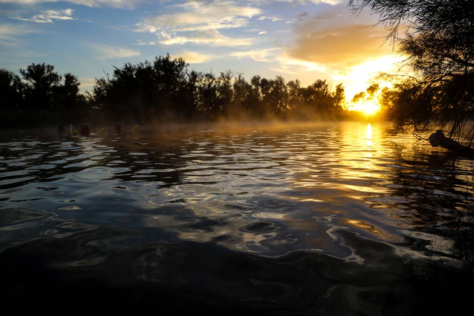 The team drove the Spring Creek Track to Dalhousie, before finally reaching Dalhousie Springs to join many other weary travellers. Dalhousie Springs is home to over 60 artesian hot springs, its highly mineralised water offering the Map Patrol an outlet to relax and wash off the physical memories of five days in the Simpson Desert.
Day 6 – Dalhousie to Mungerannie via the Oodnadatta track
The team started the day by taking the opportunity to have one last soak in Dalhousie Springs, their willingness to get a jump start on what would be their longest day resulting in the six explorers being the only ones in the water when the sun rose.
> Get a virtual tour of the trip from Dalhousie to Birdsville via Oodnadatta
After driving to and stopping at the Dalhousie Ruins, the Map Patrol’s attention turned to the famous Oodnadatta Track, which was easy going as it had recently been graded. This track is steeped in history, with its proximity to the Old Ghan Railway meaning an historical site is never far away. After stopping at Oodnadatta’s iconic Pink Roadhouse for a much-anticipated lunch, it was onto William Creek for an airplane ride over Lake Eyre. The team agreed this was one of the highlights of the trip, the visual scope available at such great heights giving each person a humbling perspective of the size and might of both La tarke Eyre and the Australian Outback as a whole.
A ter finding the time to watch the sunset at the bottom of Lake Eyre (and marvelling at the curvature of the Earth in the process), it was then a straight shoot through to Maree for a pub meal before reaching Mungerannie for the night.
Day 7 – Mungerannie to Quilpie and back to Brisbane
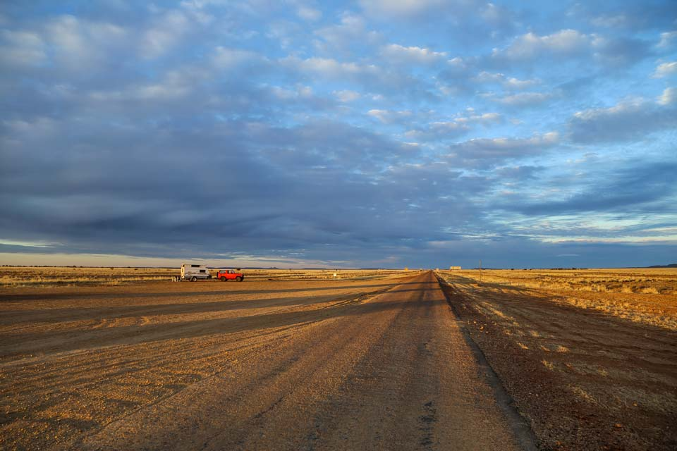
The trip wound down with the drive along the Birdsville Track, which along with the Oodnadatta Track had also been recently graded. Birdsville was a necessary stop for a Map Patrol crew hungry for some curried camel pies, before the last of the day was taken up making it to Quilpie for the evening.
As the Simpson Desert can always be counted on to do, red sand pervaded both Map Patrol vehicles as they lurched back to Brisbane. More than that though, it had snuck in and lodged in the minds of the entire team, etching memories of the world’s largest sand dune desert with a fondness that will inevitably see the Map Patrol tardrawn back there sooner rather than later.


0 comments