


With everything from historic towns to 4WD tracks, the Victorian High Country has plenty to entice. So here are our top 10 picks.
Destinations
The Victorian High Country has countless historic towns and villages spread throughout its landscape, and no road trip or 4WD adventure through the region is complete without visiting at least one of them.
Bright
Bright and its surrounding charming towns are always high on the list, particularly in the autumn months when the deciduous trees turn the landscape into shades of molten gold and red. The proximity of these towns to Mount Buffalo National Park, Alpine National Park and plenty of homegrown food and wine cannot go unnoticed either. Bright in particular is a lodestone for adventure lovers — with road and mountain biking, hiking, swimming or floating down Ovens River and snow sports in the winter months.
Beechworth
Beechworth is an ever-popular historical town in the north-east part of the High Country, and like many towns in the region, has a rich gold rush history. Explore the Beechworth Historic and Cultural Precinct, and don’t miss the Old Beechworth Gaol, the place that hosted the infamous Ned Kelly.
Southern Lowlands and Lakes
Head to the High Country’s diverse southeast to explore the beautiful southern lowlands and lakes area, where the Great Dividing Range and serene Gippsland coastal lakes region meet. Highlights in the region include Lakes Entrance and Ninety Mile Beach along the coast, Snowy River National Park, Cassilis Historic Area and the Buchan Caves.

Southern Ranges
If you’re coming from Melbourne, the High Country’s Southern Ranges are one of the most accessible sections of the Great Dividing Range. Explore the area’s rich history, particularly at small gold mining towns such as Walhalla. Or head over to Mount Baw Baw for bushwalking in summer or skiing in winter. If you’re looking for camping spots, the Howqua Hills Historic Area and Sheepyard Flat Campground are popular family-friendly choices, with swimming, hiking and varying difficulties of 4WD tracks available. And don’t miss stopping in at the historic Dargo Hotel, which opened in 1898 and is a favourite spot to enjoy a chat before tackling the Billy Goat Bluff Track.
Great Alpine Road
If you’re wanting to see just how diverse the High Country is, then the 339km Great Alpine Road definitely has you covered. Starting in Wangaratta, this year-round accessible road leads down through Ovens Valley to Harrietville then over towards the beautiful Gippsland Lakes. You’ll see everything from breathtaking mountain ranges to valleys, forests and vineyards, with plenty of welcoming villages and towns to visit along the way.
4WD Tracks
Ingeegoodbee Track (north-east)
Beginning just north-east from the historic ghost town of Suggan Buggan, the Ingeegoodbee Track is one of the hardest long-distance 4WD tracks in the Victorian High Country. The track covers steep and scrambly terrain, offering stunning views, river crossings and plenty of opportunities to test out your 4WD skills. The route to MacFarlanes Flat offers a challenge, and the flat itself has a unique historical connection to the famous Snowy River cattleman. Don’t miss seeing the ruins of the Buff Rogers Hut 1km from the main track, which replaced the historic MacFarlane Flat Hut. Four-wheel drivers can continue onto the Cobberas Trail, which offers more water crossings and several bush camps — including The Playgrounds, a popular option just 4km from Limestone Road. The track then runs to Native Dog Flat and on to Benambra.

Craig’s Hut (north-west)
While this destination is less of a challenge, the last 1.2km of the track is only accessible to those with a 4WD — unless you’d prefer to bike or hoof it (quite literally, if you have a horse handy, alternatively, strap on your walking shoes).
Craig’s Hut is one of the most popular huts the High Country has to offer and is also considered the most picturesque — aided by the fact that it is a replica of the hut that appeared in The Man from Snowy River (1984). The hut is named after one of the film’s leading characters, Jim Craig (acted by Tom Burlinson).
The hut was built in 2008 after the original was lost to fires in 2006/07, and can be found high on Mount Stirling, approximately 51km from Mansfield.

Blue Rag Range Track (north-west)
If you’re looking for more of a challenge, then the Blue Rag Range Track is a fan favourite. Starting in the charming town of Dargo (don’t miss stopping in at Dargo Pub), the track involves 113km of driving if you sign on for all the diversions. Allow a day to do it, and ensure your vehicle has high clearance for the rough, rocky tracks.

Once you leave Dargo, heading north along Dargo High Plains Road, stop in at the Treasury-Mt Ewan Huts and Gows Hotel sites for a bit of history. After passing through some fenced grazing land, you’ll reach Lankey Plain Hut; turn east along King Spur Track to Mayford to find some bush camps 11km east of Dargo High Plains Road which then joins Blue Rag Range Track. This section is steep, rocky and complete with stunning views, particularly from Blue Rag Trig Point. Once back on the Dargo High Plains Road, it’s an easy drive over to the Great Alpine Road and onwards to Hotham Heights.

Jacksons Crossing (south-east)
If you’re up for a day drive in the High Country’s south-east, then Jacksons Crossing is one of the best, winding you through the Snowy River National Park before depositing you back at Orbost. The track starts not far from Buchan, turning off from the gravel Basin Road. Four kilometres down the Jacksons Crossing Track, you’ll pass through a gate onto a public through road — from this point on you are not permitted to leave the road. The track continues, passing through gates and past the turn towards Running Creek Track. It’s from here that the challenge kicks in, involving crossing the Snowy River and two fords. There’s the option to stop in at Hicks Campground or Raymond Creek Falls Camping Area along the trail if you want to make more than a day of it. Garnets Track can be rough, but it eases out and the final stretch to Orbost offers a number of enjoyable diversions to explore, including Wall Track and Wood Point Road towards Wood Point Camping Area.
Billy Goat Bluff (south-west)
Covering 132km between Licola and Dargo, Billy Goat Bluff Track is one of the most iconic in the High Country, offering some of the most exposed, spectacular tracks in the region. Allow at least a day to achieve it, but many like to give themselves two so that they can stop and hike to Lake Tarli Karng. This is one of the steepest tracks in the state, so caution, high clearance and low range are advised.
The track heads north from Licola along Tamboritha Road, which turns to gravel before long and climbs through forest and past the Lost Plain Picnic Area. From here you’ll continue past Arbuckle Junction, McFarlane Saddle, the Moroka River Crossing and Horseyard Flat. Stop in at the Pinnacles Fire Tour, which involves a short detour, for stunning views over the countryside. Billy Goat Bluff Track then heads north along an exposed and narrow ridgeline. The rocky scramble goes downwards and finishes at Dargo. Of course, the route can be done in reverse as well!
High Country Track Conditions
Many of the 4WD tracks throughout the High Country experience regular closures between the King’s Birthday long weekend in June until the Melbourne Cup weekend in November — although these dates can vary season to season.
The closures occur for the safety of users and to ensure the tracks are kept in good condition. Wet, muddy and snow-covered tracks can become dangerous, and regular vehicle traffic can damage them. Track closures in the High Country are enforced by regular patrols.

Even if the tracks are open, it’s important to be aware that the condition and surface can vary from one visit to the next.
Tips from the Experts
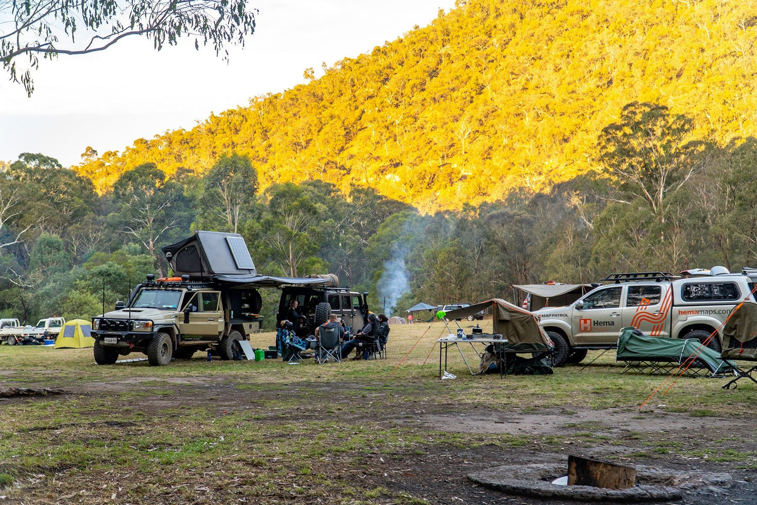
It’s always important to prepare carefully before any 4WD trip to the High Country, no matter the time of year. Our team at Hema Map Patrol have finished their remapping tour of the region, and Hema Maps fieldwork admin GIS officer Rhys Holmes commented that another of the 4WD tracks in the area, the Dinner Plains track, had “a bit of everything — mud, ruts, water holes and steep sections.”

And mentioned in the first part of this series, having the right vehicle and gear is important when heading into the High Country. The Map Patrol team upgraded the LandCruiser 79 Series in the weeks leading up to the tour, and according to Rhys these changes were much appreciated.
“The new pieces that I had put on the car put me at ease when performing recoveries in the training course, as the old pieces were weathered. I have since upgraded even more gear to lighten the car [even further], as well as adding a new rear sway bar and airbag assist to control the rocking from side to side that the car can get offroad. The Factor 55 winch hook and pulley performed flawlessly, and the Darche Eclipse 270 awning made for some much-needed shelter on those rainy nights at camp.”
On the whole, the team reported that the trip was a success and very helpful at highlighting areas where the LandCruiser 79 series could be upgraded even further — such as an enhanced 12V system which “would help with being able to use induction cooktops in the near 0 degree weather,” says Rhys. “But we made do with what we had, and it didn’t dampen our spirits, however the rain didn’t help,” Rhys commented further, highlighting once more how changeable the weather in the High Country can be. “I am now in the process of coming up with a new build design for the next generation of Hema Map Patrol’s mapping vehicles, which will be very different from the current car we have.”
When it comes to some expert recommendations on where you should go on your next trip into the Victorian High Country, Rhys recommends spending some time in Dargo. “It’s a great local spot to fuel up and grab a bite to eat either at the fuel station or the Dargo Hotel for dinner. The hotel has a great atmosphere and even offers accommodation including motel rooms, cabins or throwing out a swag in the back paddock. All types have access to amenities and hot showers.”

When it comes to campsites with terrific views, Devils Hollow Campsite, which isn’t far from the Blue Rag Range Track, was one of Rhys’s favourites and offers a few spots that look across to Mt Hotham central. Patrick Kemp, the other Hema Maps fieldwork admin GIS officer, recommends Talbotville Camping Area.
“The camping area was really nice and is located right near Crooked River. The area is quite open and has basic facilities, and the tracks we did in the area were great with lots of river crossings,” Patrick said.
But as always, Patrick recommends being conscious of adverse weather when camping in the High Country, no matter the season, so check conditions ahead of time and plan with appropriate care and consideration.
Hema Tours
If you can’t muster a ready-made convoy, join Hema Tours for a 4WD tag-along tour, full of adventure and discovery. Hema Tours are powered by the Adrenalin Offroad Centre, licensed commercial tour operators. Find out more here.
Next steps
Let us help you to navigate the Victorian High Country and find the best tracks and destinations!
At Hema Maps, we strive to provide the most comprehensive and accurate maps and guides for outdoor enthusiasts looking to explore Australia's natural wonders.
Did you find this information useful? If so, please share it with your fellow explorers. Whether it's by sms, social media, or email, your friends and fellow adventurers will appreciate the valuable tips and insights we've shared.
Let's work together to make the most of every adventure.


