


 The Map Patrol embarked on a mapping expedition of South East Queensland, exploring the off-road destinations and journeys within one of Australia's most diverse regions for four-wheel driving.
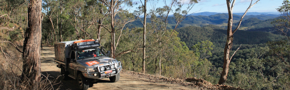
We hit the trail and decided to do a test run of the 4WD and Travelander on Bribie Island. When everything was going well and we had settled into our new on the road office, we headed for the Glasshouse Mountains and Beerburrum state forest. We met up with some crazy 4WDers that showed us how to tackle Red Hill. When their fourby ended up on its side twice we were glad we didn't try it. After that we headed south, exploring Condamine Gorge (14 crossings), the Border Ranges, Duck Creek Road (the back way into Lamington National Park) and Sundown National Park.
South East QLD Navigation & Maps
Duck Creek Road gave us an opportunity to really test the low range and high clearance capabilities in the vehicle. It was a good build up for today's adventure into Sundown National Park, where we were mostly in low range. We have also visited numerous caravan parks, camping areas and 4WD parks along the way.
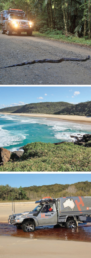
In the Border Ranges we didn't know the ‘winding road ahead’ sign really meant tyre-biting python ahead. When we couldn't get the 2 metre cold fat snake off the road we inched passed him while he took aim at the Cooper Maxxi tyres.
One pilot we met uses a Hema map to work out what is below as he flies from Melbourne across the inland deserts. He says even the sand dune lines are accurate.
Where to from here: we are being very flexible and dodging a bit of rain which will muddy up the tracks. Girraween National Park, back to the Main Range to explore Cunninghams and Spicers Gap. Then heading back to the Sunshine Coast Hinterland.
The biggest lesson as Hema Map Patrol explorers is flexibility. Much of that comes about because of the weather. After the Green Mountains we noticed some rain coming so we headed quickly south to get some 4WDs done. Sundown National Park certainly was 4WD with some pretty steep ascents and descents, giving the low gears a true workout. We sat the wet day out in Tenterfield and headed to Girraween National Park as soon as the skies cleared. Little did we know that after the rain, the chill sets in. A night at -3 degrees was a bit chilly but a climb up to the Pyramid in the morning warmed us up.
Another chilly night was in the Bunya Mountains but we had invested in some flannelette sheets, hot water bottle and beanies. The red-necked wallabies didn't seem to feel the cold like we did.
After the cold came the rain. We thought a night of drizzle wouldn't affect the track out of Nanango too much. When we were going sideways on a track with sheer drop on one side, we changed our minds. But we had some good muddy tyre shots. As the forecast was for heavy rain we decided canvas was not the best option. We got soft and opted for a room on the Sunshine Coast. Lucky. 120mls would have tested our waterproofness.
The best place for water drainage is sand so we headed for Great Sandy National Park. What a beautiful place. Water came in the form of a very high king tide due to the full moon. We were high and dry. I think a few campers may have had soggy tents.


