


SALVATOR ROSA
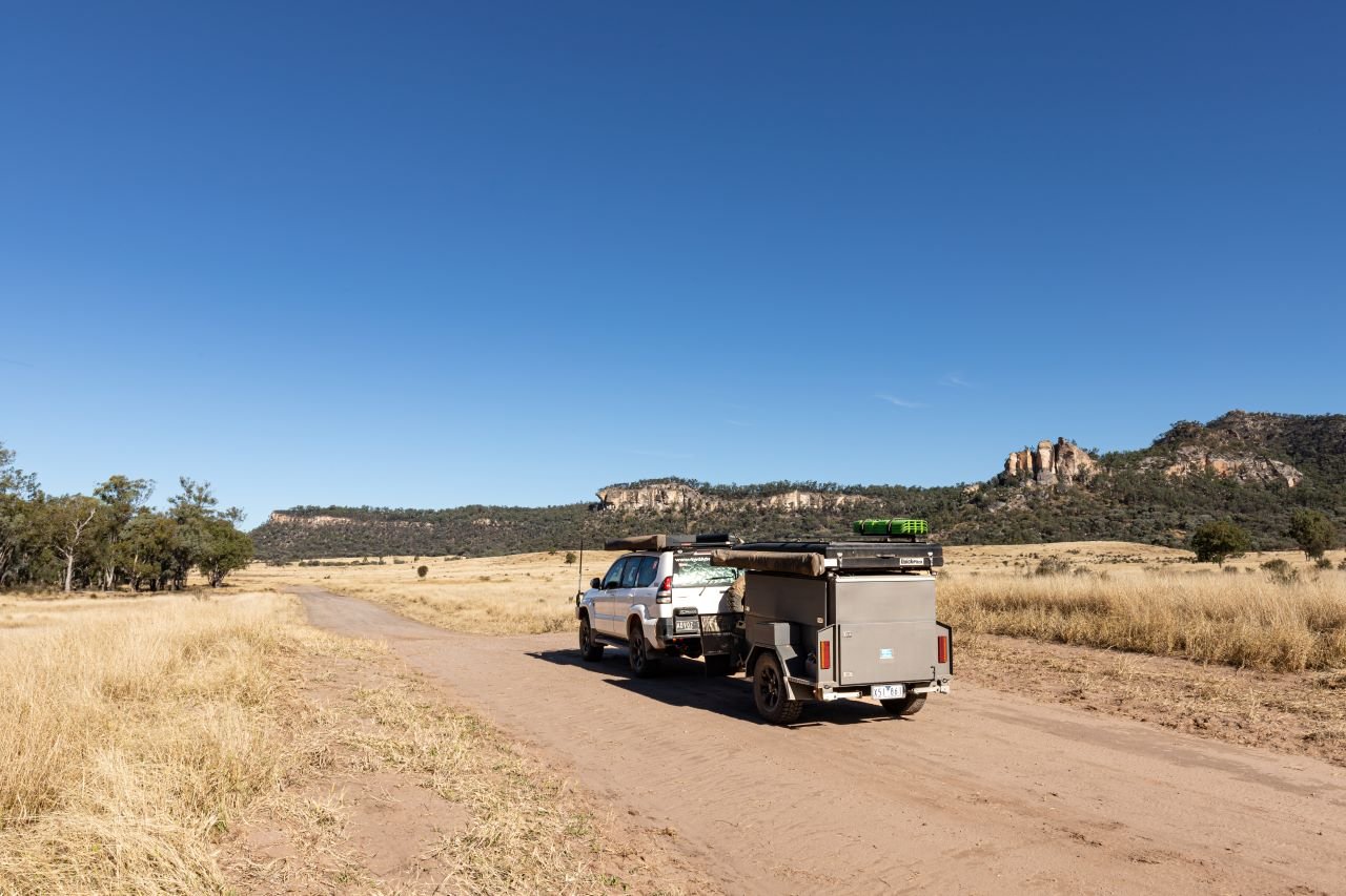
The Salvator Rosa section of Carnarvon National Park is reached by taking the Dawson Development Road, either from Springsure in the east, Tambo in the south or Alpha to the north. This fabulous drive takes you through prime cattle country with stunning geological features.
The cliff face of Bull Creek, with its weathered formations sculptured by weather and time, with Autograph Rock, the precariously balanced Stool Rock, and the Monument off in the distance. This sheer white escarpment, known as Boodyadella to the local Aboriginal people, is a visual splendour as you make your way towards Salvator Rosa.
Follow the signs, passing Cungelella Station before turning onto the track that leads 18km to the Nogoa River campground. The first section is black soil, treacherous when wet, so it’s best to check the road conditions before heading out this way.
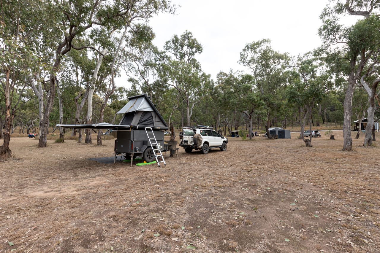
The campground is a couple of large, sectioned spaces with communal fire pits, tables, an eco-toilet and a rainwater tank with non-potable water. Bookings are required and must be completed online before your visit, or you may be fined. This is the only place where camping is allowed in this section of the park.
In 1846, the dramatic landscapes of the region inspired Major Thomas Mitchell to name the area after a 17th Century Baroque landscape painter, Salvator Rosa, whose works he liked. Most of Salvator Rosa is covered with Eucalypt woodland and open forest whilst shallow soils on the ridge tops support forests of gum-topped ironbark. The exposed rocky outcrops are scattered with black cypress pines. In spring the wildflowers light up the landscape.
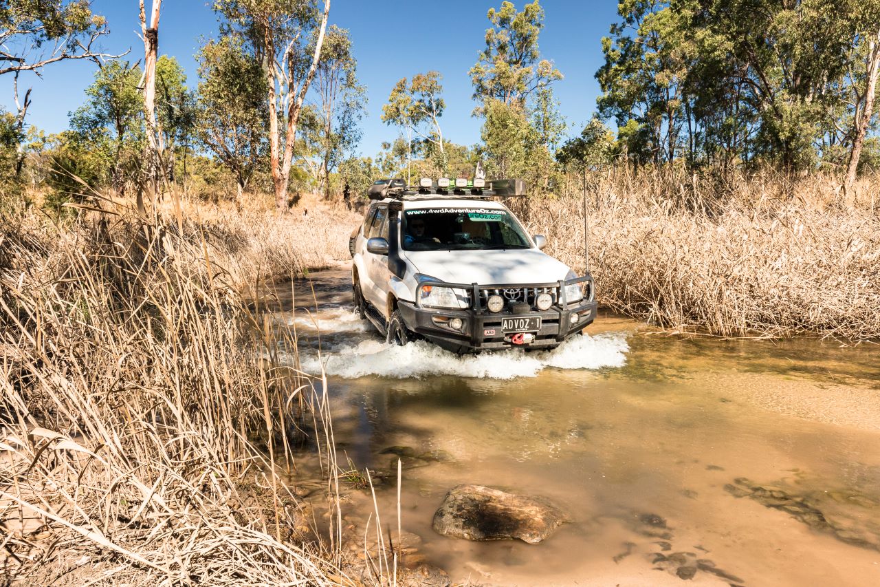
The self-drive tour of the park is suitable for high clearance 4WD vehicles, with the first challenge crossing the Nogoa River. Its sandy base is generally solid and wooden planks have been buried on the northern entry/exit point to reduce erosion caused by water runoff from your 4WD.
The sandy track is deep in only a few places but by sticking to the wheel ruts you’ll be fine. Mitchell Springs is the furthest most point of interest, a permanent watercourse with dense stands of Phragmites australis reeds that provide a haven for frogs and fish, molluscs, and other freshwater invertebrates.
Further downstream, the waters from Mitchell Springs seep over peat bogs before sinking into the sand and flowing underground, resurfacing as Louisa Creek at Belinda Springs.
There was once a walking trail out to the old yards where Major Mitchell set up base camp on 5th September 1846. If you can find the remnants of the stockyard, all that remains are a few fence posts and the engravings in the sandstone cliff wall where the cross-posts used to be.
Homoranthus Hill rises 460m and a 150-metre walk leads to the top of a sandstone outcrop that offers 360-degree views of the surrounding landscape including excellent views of the Three Sisters and Spyglass Peak.
There is a 2km circuit walk around the base of Spyglass Peak past vivid, orange-barked yellow jacket trees, however, you can’t climb it. The peak gets its name from the weathered 10-metre diameter hole near its summit.
Stopping at Belinda Springs you’ll hear the rush of water as you enter a smothering of ferns that thrive in the moist conditions. The crystal-clear water of Louisa Creek gushes over the rocks, disappearing amongst the clusters of ferns. Around four million litres of water flow daily into Louisa Creek from Major Mitchell and Belinda Springs.
The junction of Louisa Creek with the Nogoa River is another top spot to spend some time. A shelter and picnic table are located at the car park and it’s only a short stroll down to the river where you can relax in the crystal waters. From here it’s a short drive back to camp, crossing the Nogoa River one more time.
MOUNT MOFFAT
Plenty of room at West Branch and is very popular with those tackling the 88km Carnarvon Great Walk.jpg
Departing from Injune on the Carnarvon Highway, turn left onto Westgrove Road just north of town and follow it to the junction with Mt Moffat - Injune Road. Westgrove takes you through scenic state forests and grazing country. The road is slippery when wet, especially on the black soil country between Glendonnell and Sunrise.
The Mt Moffatt Injune Road is in better condition aside from a few washouts that need careful negotiation, especially with a camper attached. Once inside Carnarvon National Park, recent rains meant that the Kenniff Murder Site was inaccessible.
The Rangers Station was once the homestead for the Waldron family who took up the Mount Moffatt lease in 1939. The stockyards, with original sections from 1902, are a reminder that cattle used to roam the highlands. Mount Moffatt was purchased by Queensland Parks in 1979.
Take a self-drive and visit Lots Wife, a pillar of sandstone standing tall and proud in the scrub, before checking out Kookaburra Cave. Kookaburra Cave is home to several Aboriginal stencils and engravings in the sandstone. Can you spot the hand stencil that looks like a kookaburra?
Another POI is the spectacular Marlong Arch where the soft precipice sandstone has been eroded by the wind and rain to create this natural arch. At Dargonelly Rock Hole, Marlong Creek has carved the rocks over time with torrents of water that have created holes holding water long after the rains have gone.
We recommend returning to the Visitor Orientation Site at the park entrance as directly opposite a sandstone bluff rises from the sandy soil. Mottled like lizard skin, Cathedral Rock is a short 380m return walk. A 5.8km circuit walk also begins at the Orientation Site and takes in three exceptional highlights.
The first is the Chimneys, three columns of basalt rock that have worn away from the sandstone bluff. Standing separated, themselves weathered to show off colours of orange, yellow and grey.
The second is the Tombs rock art site, a special creation site for the Bidjara people. There are over 400 stencilled motifs along the sandstone wall at the burial site, carbon dated as far back as 19,500 years. Unfortunately, the site has been desecrated with all burial remains stolen by the early 1900s.
The third highlight is the Looking Glass, an eroded section of sandstone pillar that has a couple of holes worn away. Allow three hours to complete the circuit walk, and morning is the best time as it is cooler.
The High-Country Track is where you lock it into 4WD before tackling it. The first point of interest is Kenniff Lookout. Patrick and James Kenniff were known cattle duffers who had their lease revoked in 1902.
The peak of Mount Rugged was used by the Kenniff brothers as a lookout. The Kenniffs were eventually captured and charged with murdering and burning the remains of a policeman and station manager. Patrick was hanged and James was sentenced to life imprisonment.
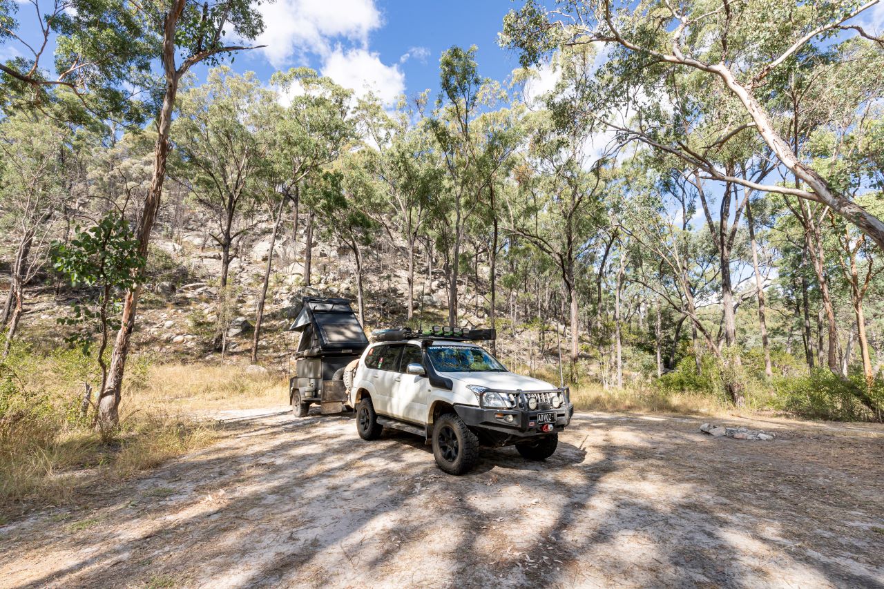
The climb up the range takes you up over 1100m with the Rotary Shelter Shed campground and Top Shelter Shed as great spots to stop for a picnic lunch and take in the stunning views across the roof of Queensland.
Continue following the track and enjoy the magic of the Mahogany Forest. Wind down your windows and smell the forest, sweet and clean. The track concludes at the head of Carnarvon Creek, though you’ll rarely see any water here.
There are four designated campsites that must be booked online:
- Dargonelly Rock Hole and West Branch camping areas have pit toilets, fire rings and non-potable water are available. These sites are larger and would suit camper trailers and caravans.
- Rotary Shelter Shed and Top Moffatt camping areas are accessible by 4WD only. Both have a pit toilet. Limited rainwater and fire rings, and the Rotary site is only small and not suitable for trailers or caravans.
KA KA MUNDI
It’s a great drive across the plains on Buckland Road, the gravel road crossing plenty of grids that separate herds of fattened cattle. Then, out of nowhere, you’re driving on a long straight stretch of bitumen, an outback runway for the Flying Doctor.
Turn onto Glentana Road and follow the signs for Ka Ka Mundi before veering onto Yandaburra Road, where the views across the fields are stunning. There are a couple of gates once past Yandaburra Homestead, be sure to leave them as you find them.
Upon reaching the gate into Ka Ka Mundi, the single-lane track leads the springs. The drive would be slippery when wet, so keep away if you know rain has fallen here. Several water diversion humps will keep you on your toes, especially if towing.
The campsite at Bunbuncundoo Springs is tight with just enough space for a couple of campers. Fires aren’t permitted in this section of Carnarvon National Park; however, the ring of stones and a pile of ash sadly show some people have ignored the signs.
The springs are a bit of a challenge to get to, jumping over the stream, squeezing between trees, climbing over logs, following the feint-trodden trail, over some rocks to see where the springs exit the sandstone nearby. This water is respected by the Kairi people the Traditional Custodians who speak for country at Ka Ka Mundi. The healing powers help children with bone problems when they bathe in the water.
Next steps
At Hema Maps, we strive to provide the most comprehensive and accurate maps and guides for outdoor enthusiasts looking to explore Australia's natural wonders.
Did you find this information useful? If so, please share it with your fellow explorers.Whether it's by sms, social media, or email, your friends and fellow adventurers will appreciate the valuable tips and insights we've shared.
Let's work together to make the most of every adventure.


