WA Topo Map Update
Hema has recently secured access to the Landgate topographic maps (WA Topo) for Western Australia.
The Hema HX-1 is Australia’s leading GPS navigation system for on and off-road travel; ideal for 4WD, caravan, camping, touring and adventure travel.
Hema has recently secured access to the Landgate topographic maps (WA Topo) for Western Australia. Now available for all Hema HX-1 navigator and Hema Explorer Pro subscribers. The WA Topo maps complement existing Hema mapping and enhances the experience for all Western Australia map users - making it easier than ever to explore with confidence.
Used in EXPLORE mode, the new map source covers zoom levels 4 to 15 (approximate scales 1:35,000,000 - 1:18,000). It is provided under License to Hema © Western Australian Land Information Authority (Landgate).
Rob Boegheim, Hema’s Chief Explorer says, “We are excited to finally provide access to the WA Topo maps for our customers as these maps provide such rich topographic, 4WD track and walking trail detail for all kinds of outdoor activities”.
This latest update comes on the heels of a recent update to guard against intermittent GPS signal loss and is now available for the Hema HX-1 Navigator.
Owners of an HX-1 can quickly and easily update their device when it’s connected to WiFi – simply follow the step-by-step guide below to add the new map layer.
Note: Be sure to download the desired area offline to your HX-1 or mobile device before you head outdoors and be conscious of potentially very large file sizes. The WA Topo map is highly detailed. Downloading of large areas may exceed the memory capacity of the HX-1 (or your own device).
To get the most out of the WA Topo, consider the specific area you require very detailed mapping for and download only that area. The HX-1 has excellent touring detail in the pre-loaded maps.
For example: Purnululu National Park in WA covers 239,723 hectares. The WA Topo map download for Purnululu is approx 180MB. The pre-loaded HX-1 map content is perfect for this trip and the downloaded WA Topo map will give extra detail for tracks and hiking. Simply download the topo map prior to the trip when you are in an area with good wifi and internet access.
Step 1
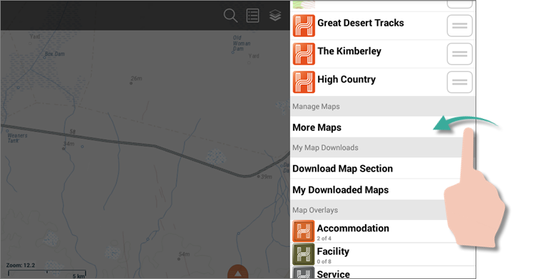
Swipe in from right-hand edge of screen to open the Layers panel. Swipe up to scroll the Layers panel down until you see the More Maps option. Tap the More Maps option.
 Step 2
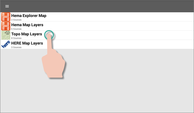
On the More Maps panel, tap the Topo Map Layers option. There should be 8 sources shown for Topo Map Layers.
 Step 3
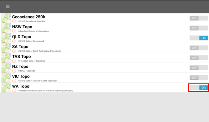
Tap the Off switch to the right of the WA Topo map source to turn it on.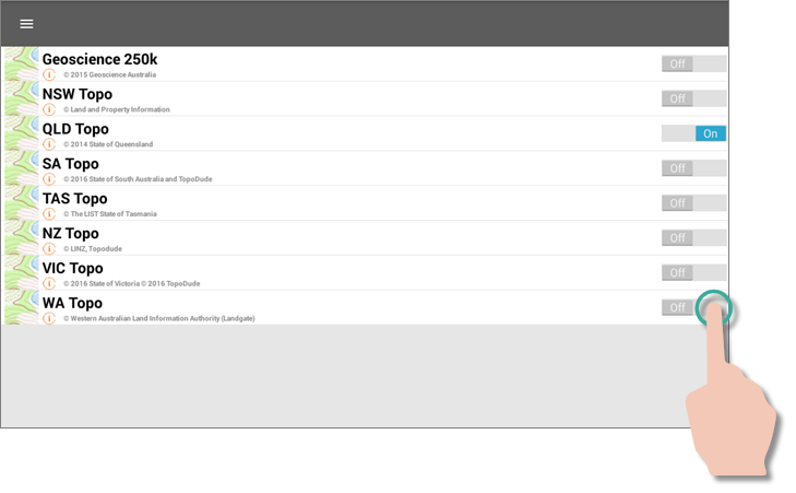 The WA Topo map layer will now appear switched on.
 Use the back button to reverse back out to the map screen, and then re-open the Layers panel. You should now see that the WA Topo layer has been added to the Visible section of the Layers panel.
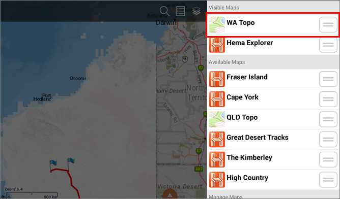 If the WA Topo is above the Hema Explorer map layer, then it will be drawn on top of the Hema Explorer layer as shown below.
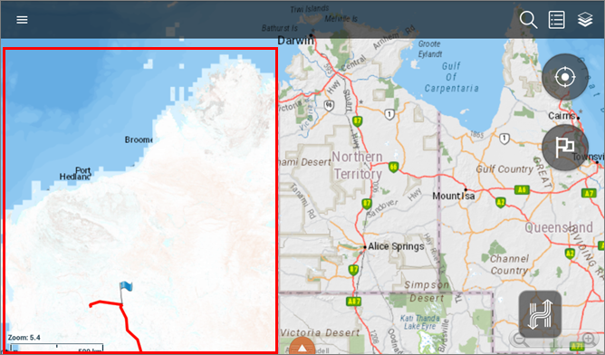 If the WA Topo map layer is BELOW the Hema Explorer layer in the Visible section of the Layers panel, it will NOT be visible in the map panel (as it is hidden by the Hema Explorer layer).
For more information on map layers available in each region visit: kb.hemamaps.com/article/AA-00533/69/


0 comments